After a brief interlude of mild temperatures Saturday, a warm-up is forecast to begin Sunday as upper-level high pressure builds into California, the National Weather Service said. High temperatures will climb by several degrees on Sunday.
California just recorded its hottest September on record, according to the National Oceanic and Atmospheric Administration, and the state looks to be stuck in a nearly endless loop of hot, dry weather.
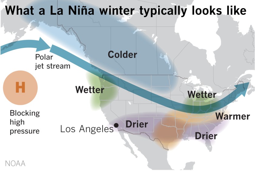
With a strong La Niña developing, the dry pattern is looking ever harder to break, and could be settling in to stay for a while. The forecast for the upcoming week is seasonably Santa Ana-ish, and does nothing to contradict that supposition.
Gusty winds are expected to develop below passes and canyons in the Santa Ynez Range of southern Santa Barbara County on Sunday night. North to northeast winds will also affect the Interstate 5 corridor and valleys of eastern Ventura County as well as northern and western L.A. County.
Read the full story on LATimes.com.
