A Pacific storm system made its way into Southern California Friday, drenching the Central Coast with rain and prompting temporary flash flood warnings before moving into Ventura, Los Angeles and Orange counties.

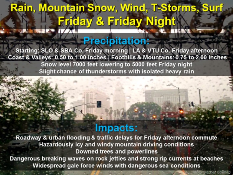
The storm reached San Luis Obispo and Santa Barbara counties first, dumping a quarter-inch of rain in Summerland in approximately four minutes shortly after noon, according to the National Weather Service.
As heavy rain inundated parts of southern Santa Barbara County, the weather service issued a flash flood warning for the Solimar burn area, warning that heavy rain was about to hit Ventura County around noon. Possible impacts included mud and debris flows.
Moderate to heavy rain was also headed toward the Springs Burn in Camarillo shortly before 12:50 p.m., and was expected to soak the area.
In Simi Valley, rain started falling shortly after 12:40 p.m., around the same time when the funeral for Nancy Reagan concluded at the Ronald Reagan Presidential Library.
In Malibu, Zuma Beach reported wind gusts of 40 knots — about 46 mph — during a downpour. Gusts of up to 40 knots were predicted down into southern Orange County as the storm moved on.
While most areas will experience moderate rainfall, forecasters warned of the possibility of locally heavy rain along south-facing coastal hills near any developing thunderstorms.
Potential impacts included roadway and urban flooding, as well as traffic delays during the always hectic Friday afternoon rush-hour commute.
“Be prepared for delays for your Friday afternoon commute!” the National Weather Service Los Angeles tweeted.
In the mountains, motorists can expect “hazardously icy and windy” driving conditions, the weather service stated.
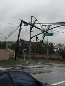
Powerful winds with gusts of to 60 mph in the mountains and deserts were also predicted, creating the potential for downed trees and power lines.

Several downed power lines were reported in Riverside, where an estimated 3,000 residents were without power Friday evening, according to the Riverside Fire Department.
The storm was expected to shift east during evening hours, but gusty winds and scattered showers will likely linger, according to the forecast.
Precipitation should taper off by early Saturday.
In addition to rain, mountain areas may receive several inches of snow, with levels dropping from 7,000 feet during the day to around 5,000 feet by nightfall, the weather service said.
KTLA’s Melissa Pamer contributed to this article.
Latest rainfall projections for Friday. Be prepared for delays for your Friday afternoon commute! #LArain #cawx pic.twitter.com/S15WfvblBK
— NWS Los Angeles (@NWSLosAngeles) March 10, 2016
Here is the potential thunderstorm outlook for Fri-Fri night from the @NWSSPC across CA. #LArain #cawx pic.twitter.com/1OlZ9VUz5d
— NWS Los Angeles (@NWSLosAngeles) March 10, 2016
Satellite view of Friday's storm. Unstable air will generate t-storms w/ gusty winds & small hail. #LArain #cawx pic.twitter.com/U2iSf13Dv0
— NWS Los Angeles (@NWSLosAngeles) March 10, 2016


