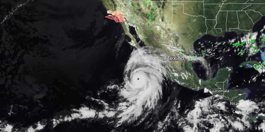
For the first time in history, a tropical storm watch has been issued for portions of Southern California as Hurricane Hilary moves northward from the Pacific coast of Mexico.
The Tropical Storm Watch went into effect Friday for areas of Los Angeles, Orange, Riverside, San Bernardino and San Diego counties. A full list of advisories can be found here.

What is a Tropical Storm Watch?
The National Weather Service says a Tropical Storm Watch means tropical-storm-force winds are possible somewhere within this area within the next 48 hours. To put that in perspective, peak winds from Hilary could reach 30-40 mph with gusts to 55 mph after making landfall.
According to weather officials, Hilary’s window for tropical storm-force winds is expected to be Sunday afternoon until early Monday morning.
NWS has advised residents in these areas to plan for hazardous wind by preparing their properties ahead of time.
Possible impacts
Potential impacts from tropical-storm-force winds, according to NWS, include:
— Damage to porches, awnings, carports, sheds, and unanchored mobile homes.
— Unsecured lightweight objects could be blown about.
— Large tree limbs may be broken off and/or trees snapped or uprooted, especially in places where trees have shallow roots, such as coastal and valley locations that don’t typically experience strong winds.
— Some fences and roadway signs may be blown over.
— A few roads may be impassable from debris, particularly within urban or heavily wooded places.
— Hazardous driving conditions on bridges and other elevated roadways.
— Scattered power and communications outages
Flooding threat
Hilary could bring excessive rainfall, which has the potential for extreme flooding in these listed areas. NWS anticipates 3-6 inches during peak rainfall this weekend.
Weather officials have encouraged residents to create emergency plans in the case of extreme flooding from heavy rain.
NWS warns evacuations and rescues are likely during Tropical Storm Watches


