What remains of Tropical Storm Kay continued to break apart over the Pacific Ocean and Southern California Saturday after delivering heavy rainfall in some areas, strong wind gusts that toppled trees, and high tide dangerously close to homes along the coast.
In Long Beach, sand berms held up overnight, sparing homeowners from any flood-related damage during peak tide.
“There was no significant inundation beyond the boardwalk in the peninsula,” the city posted on social media. “However, minor flooding was noted on a few local streets. There are currently no reports of property damage.”
Residents expressed gratitude to crews who worked around the clock to maintain the integrity of the berms.
“The guys out here working on the beach have done a fantastic job. What they’re doing is amazing,” one couple told KTLA.
A high surf advisory remains in effect until Sunday morning for much of the Los Angeles area coastline.
The National Weather Service warns, “large breaking waves can cause injury, wash people off beaches and rocks, and capsize small boats near shore.”
Dangerous currents were evident in Venice where lifeguards rescued at least 11 swimmers who were caught in the rip currents Friday.
“The lifeguards here in Venice, we’re quick to act,” said Spencer Parker, a lifeguard captain for the Los Angeles County Fire Department.
NWS also issued a Coastal Flood Advisory for Catalina and the Santa Barbara Islands where 5- to 9-foot waves were expected.
On Friday night, Kay had maximum sustained winds of 40 mph with gusts strong enough to take down trees, as was witnessed in Norwalk, Florence-Firestone and Cerritos, among other places.
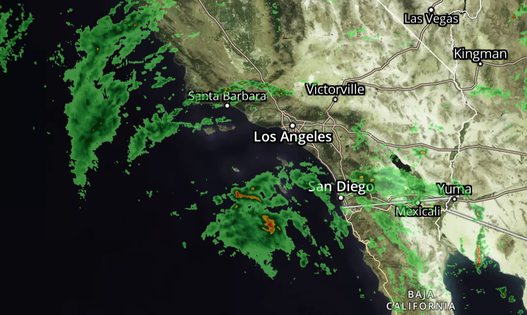
While the worst of Kay, now a post-tropical cyclone, has passed, Southern California could still see lingering impacts through the weekend.
“It has weakened quite a bit as it has made its way into the cold, Pacific waters,” KTLA 5 forecaster Kacey Montoya said. “We do have the threat of more showers and thunderstorms (Saturday) afternoon, particularly for inland areas.”
Twenty-four-hour rainfall reports for the L.A. area ranged from less than one-tenth of an inch to nearly three-quarters of an inch. Conversely, the mountains of San Diego County received more than three inches in some locations.
A Flood Watch remains in effect for the Inland Empire, mountains and deserts until Sunday morning.