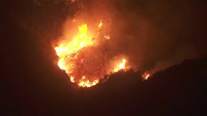
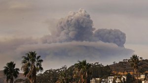
The Thomas Fire, which became the fifth largest blaze in California history on Sunday, is likely to continue to grow Monday as it burns deeper into Santa Barbara County and threatens thousands of homes.

Gusty Santa Ana winds will push the fire, which has burned 231,700 acres — or 362 square miles, according to a Cal Fire update Monday morning. The fire was 20 percent contained.
The extreme fire behavior will hinder control efforts Monday and have firefighters focused again on structure protection, Cal Fire stated. Roughly 18,000 structures remain threatened, according to Cal Fire.
Officials said 869 structures have already been destroyed in the massive blaze.
The fire is threatening the communities of Montecito, Summerland, and Carpinteria. Gusty northeast winds will also cause the fire to threaten areas within the city of Santa Barbara.
In Summerland, where ash could be seen filling the air, one local resident who had been evacuated told KTLA her home was threatened after a prior one had already been destroyed in another wildfire.
“We’re pretty concerned,” said Mary Carmody. “Our house on Coyote has already burned once in the Tea Fire — all the way down. So it was a complete loss and we just recently moved back into the rebuilt home.”

Still, she said she’s holding onto hope as firefighters battle the massive blaze.
“It seems like the firemen are doing a terrific job,” she said.
Officials are working on evacuation operations ahead of the westward fire growth, Cal Fire stated.
Some evacuation orders in the Ojai area were lifted Monday afternoon — the following list has been updated to reflect those changes.
More evacuation orders were lifted for the city of Ventura Monday, but mandatory evacuations remained in place for the following areas in Ventura County:
Ventura
- North of Foothill Road from Day Road to Kimball Road
Entire Community of Casitas Springs
- Evacuate to Ventura County Fairgrounds – 10 West Harbor Blvd., Ventura
Ojai/Lake Casitas
- Unincorporated areas west of Ventura, north of State Route 150, east of Casitas Ranger Station, south of Los Padres National Forest
- Los Encinos Road to Burnham Road, South of SR 150, and Lake Casitas Recreation area south of SR 150
Unincorporated Ventura County Area
- Residents and day visitors of Rose Valley
Ventura County North Coast Area
- Boundary of Hwy 33 on the north to Casitas Vista Road, northwest to Hwy 150, Hwy 150 (Casitas Pass Road) west to US 101 and south on US 101 (including Pacific Coast Highway) to Emma Wood State Beach
Unincorporated area of Fillmore
- The area of Hall Road to the west, Sespe Creek to the east, Fillmore City limits to the south, and Los Padres National Forest boundary to the north
Mandatory evacuations are in place for the following areas in Santa Barbara County:
- North of Highway 192 to East Camino Cielo between Highway 150 and Mission Canyon Road.
- Hot Springs Road to Buena Vista Road, from Highway 192 north to East Camino Cielo
- Buena Vista east to the County line and north of Highway 192 (E. Valley Road), to include the 900 block of Park Lane east.
- Carpinteria area East of Toro Canyon Rd. East to HWY 150, North of Hwy 192 to Camino Cielo.
- Carpinteria area East of intersection of Casitas Pass Rd & Hwy 192, North of Hwy 192, & West of the county line.
- SR-192 north to E.Camino Cielo between Toro Canyon Rd and Linden Ave.
- Shepherd Mesa, Gobernador Canyon and Rincon Point.
Cal Fire provided a link to an evacuation map.
#ThomasFire Mask Distribution for 12/12. N-95 masks require a tight seal to be effective & the available adult sized masks will provide limited protection for most children. Those with heart & lung conditions should consult their health care provider before using an N-95 mask. pic.twitter.com/EDrPsAZWN2
— Santa Barbara County (@countyofsb) December 12, 2017
More than 6,397 firefighters, alongside 856 engines are working with 27 helicopters and 48 water tenders in efforts to eventually get the upper hand on the fire.
The blaze was ignited Monday evening in Ventura County and spread to southern Santa Barbara County overnight Saturday.
The cause of the fire has not been determined.


