This is an archived article and the information in the article may be outdated. Please look at the time stamp on the story to see when it was last updated.
Another Santa Ana event, possibly the strongest of the season thus far and comparable to that seen during the Thomas and Woolsey fires, is set to bring ferocious winds and the threat of critical fire weather to Southern California starting Tuesday night.
The combination of powerful offshore winds and dry air is expected to bring “very high fire danger” to the region through Thursday morning, according to the National Weather Service.
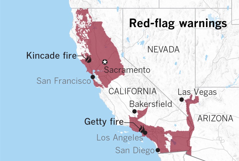
Humidity will drop into the single digits throughout the region, in some places down to 1 to 2 percent. The National Weather Service warned those conditions could create the potential for “very rapid fire spread,” as well as “extreme fire behavior with any fire ignitions.” Warning goes into effect at 11 p.m. Tuesday and expires 6 p.m. Thursday. But the warm, dry conditions are likely to continue into early November, and may even linger through the middle of the month, according to NWS meteorologist Alex Tardy. That could spell for trouble for a state that has already experienced a series of destructive wildfires in just the past few weeks. As of Tuesday, California has 11 active wildfires that Cal Fire considers significant. Among them are the Tick, Getty and Saddleridge fires in L.A. County, and the Kincade Fire in Sonoma County. The state has experienced an uptick in fire activity over the past week, driven primarily by high winds and low humidity that have helped blazes spread rapidly. “This is, unfortunately, now California’s normal,” Cal Fire Capt. Scott McLean said at a Monday briefing. “And it’s absolutely vital that everybody in this state be prepared for these weather events.” KTLA’s Melissa Pamer contributed to this article.Here's a look at the wind gust forecast. The darker reds and purples highlight the main areas affected by the Santa Ana. #CAwx pic.twitter.com/urUXpanLKI
— NWS Los Angeles (@NWSLosAngeles) October 29, 2019


