A three-part storm moving through Southern California, which began as a weaker system, is gaining strength by the minute, impacting both coastal and mountain communities.
Rainfall is expected through Monday with totals between 0.75 to 2.5 inches across the foothills and mountains, with coastal and valley regions seeing anywhere from 0.5 to 2 inches of rain, according to the national weather service.
As gusty winds out of the south and southeast whip up, NWS forecasts a 20%-40% chance of thunderstorms and snowfall in elevations of 7,000 feet and higher.
In Orange County, which is expected to see rain through Monday morning, there are concerns over high surf, strong rip currents and winds hitting around 25 miles per hour.
“The water, it churns really hard, so you have a tendency to get really bad riptides,” Seal Beach resident Farrah Kletke told KTLA’s Rachel Menitoff. “They put a really high sand berm out to protect the homes and keep it from flooding.”
Officials warned beachgoers to stay out of the water through Tuesday because of the dangerous tides, as well as harmful bacteria and possible runoff from rains.
While there’s a chance for minor flooding during high tide, forecasters are not expecting anything like the 10–15-foot swells seen last month in beachfront communities across L.A. and Ventura Counties.
“The last storm that went through did go over the berms,” Kletke recalled. “We just don’t know until it happens.”
In burn scar areas, K-rails have been set up to protect surrounding homes. Longtime Duarte residents say their hillside has regrown since the 2016 Fish Fire and the resulting mudslides in 2017 but are happy to have the added protection in their neighborhood.
“Unless it’s really intense, super intense, within like a half hour period, if we get a couple of inches, three inches of rain over 24 hours, and spread pretty evenly, there won’t be any issue,” Duarte resident John Fasana said.
L.A. County fire crews have also been on high alert in case of flooding or water rescues.
“The water is obviously very strong,” Christian Reynoso, with the L.A. County Fire Department, told KTLA. “It only takes six inches of moving water to knock down an adult, so be respectful of moving water.”
Back in Seal Beach, resident Barbara Bartee said she’s already starting to see the effects of the impending storm.
“Just walking the pier right now, it was interesting to see how big that swell is coming in. It’s kind of funny because you don’t seem that as that big until you’re about halfway through the pier where they shut it down,” she said.
Officials have issued evacuation warnings for an area north of Topanga Canyon in case of possible mudslides.
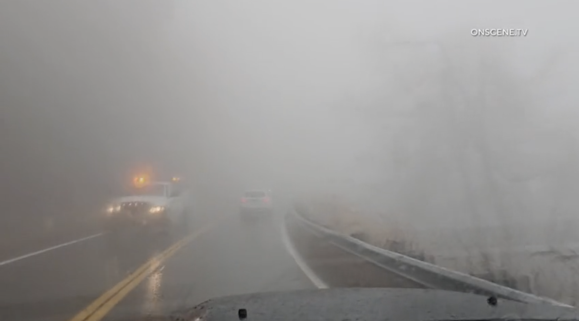
The wet weather will create hazardous driving conditions throughout the Southland, with limited visibility and possible road flooding.
“If you are headed out, please be very careful driving over the next couple of days, especially when heading to work or school on Monday morning,” KTLA Weatherman Kaj Goldberg advised. “Monday morning will be very dicey. Streets will be slick. Leave yourself plenty of extra time to get to work or school.”
The stormy weather is expected to move out by tomorrow night, ushering in warmer temperatures by the end of the week.