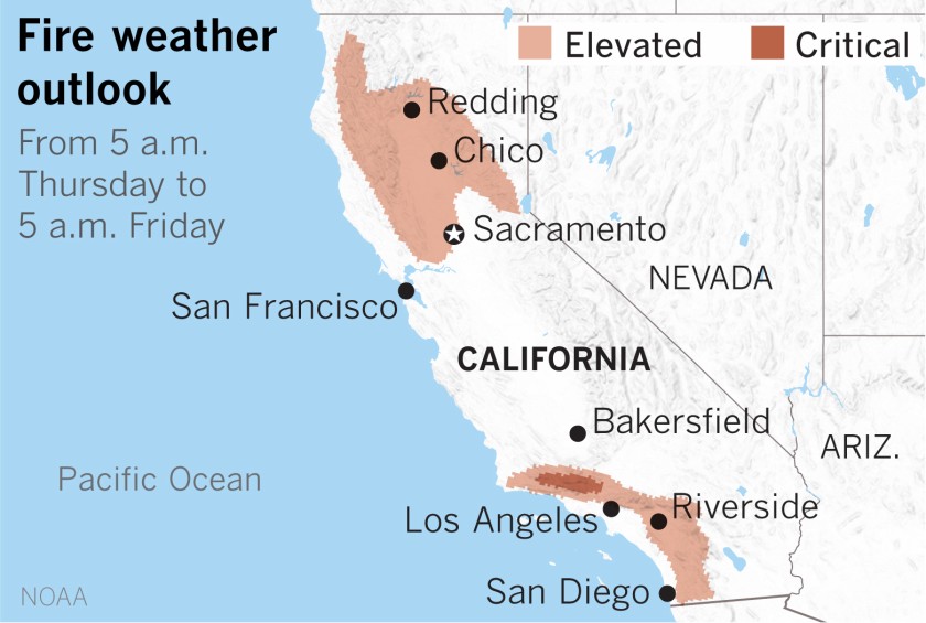
A record-breaking fall heat wave and gusty Santa Ana winds will team up to heighten fire danger across a swath of Southern California this week, with officials saying the bone-dry, blustery conditions will make it easier for new blazes to both start and spread.
Given the foreboding forecast, the National Weather Service has issued a fire weather watch covering the Santa Clarita Valley, Los Angeles and Ventura county mountains, mountains and coastal slopes of the San Bernardino and Santa Ana ranges, as well as areas of the Inland Empire below the Cajon Pass.
Conditions are expected to be most critical late Thursday night through Friday afternoon, according to David Sweet, a meteorologist with the National Weather Service in Oxnard.
“Around 9, 10 a.m., that’s when the Santa Ana winds will peak and provide that risk of rapid spread to fires because of wind,” he said Thursday. “And then in the afternoon, we’re looking at low relative humidities — down to the single digits.”
Read the full story on LATimes.com.
