Most of Wednesday will provide a pleasant break for Southern California after days of pouring rain but another round of showers will move in later tonight.
Lingering rain was still falling early Wednesday over parts of southern Orange County and snow flurries are expected to continue over the mountains as the remaining moisture gets squeezed out.
The cold air also caught up with the storm bringing snow levels down to around 4,000 feet Wednesday morning, KTLA Meteorologist Henry DiCarlo said.
The rest of the Southland can look forward to partly cloudy skies most of the day but another weak storm will arrive Wednesday evening.
“It’s funny, we call it weak. It actually would be a decent storm for us … but considering what we’ve been through, it’s a weak storm,” Henry said.
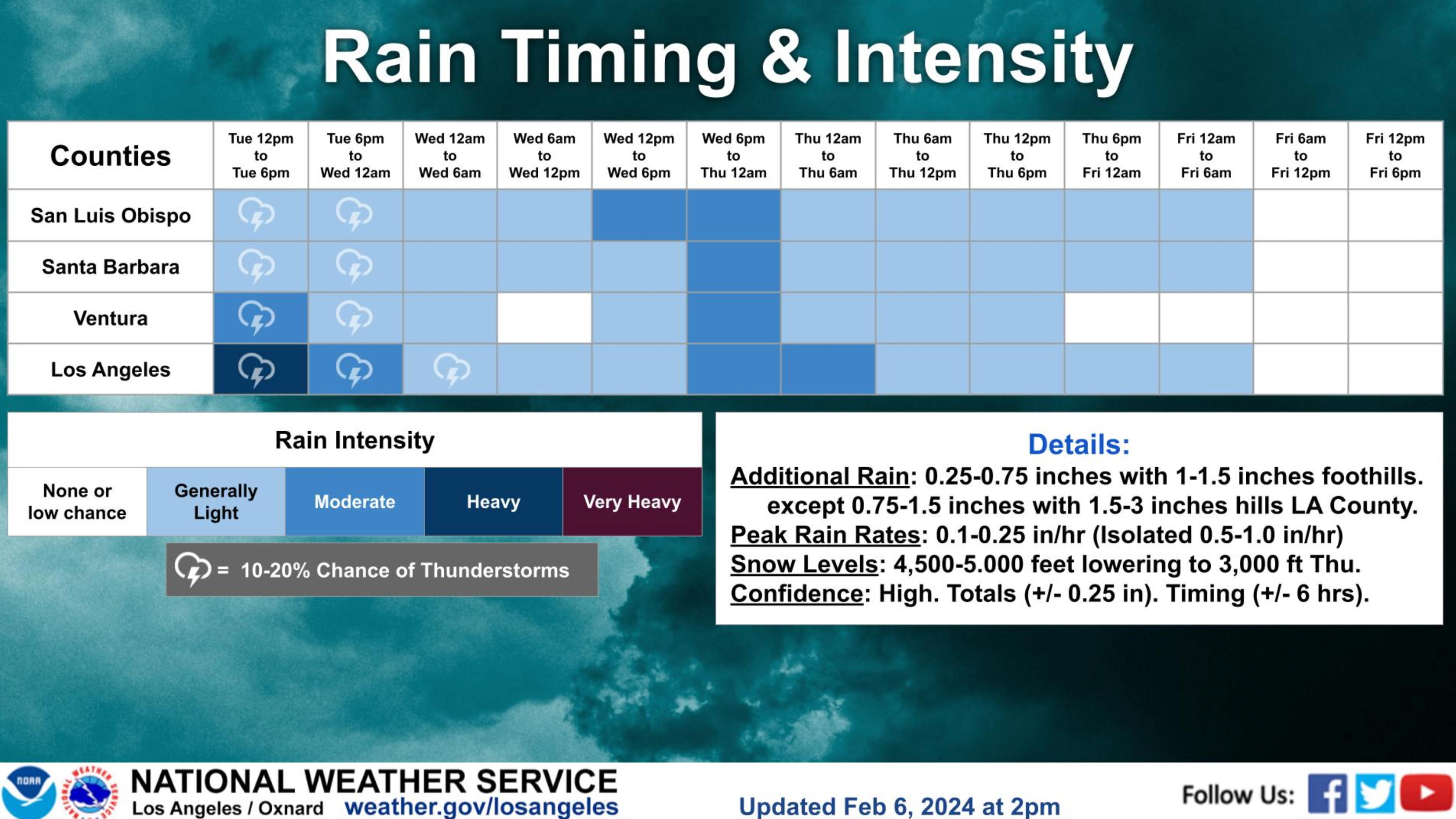
The weather system is expected to linger into Thursday morning, bringing between a quarter of an inch to an inch of rain to most coastal and valley areas, Henry said.
The National Weather Service says as much as three inches could fall in some Los Angeles County foothill areas.
That much rain ordinarily wouldn’t be a big deal, but with the ground as saturated as it is, the threat of mudslides is very high, Henry said.
Drier conditions will arrive after this storm and the weekend should bring sunny skies and beautiful views of our snowcapped mountains.
Warmer temperatures are expected to return next week.


