A magnitude 5.1 earthquake followed by a series of aftershocks shook Southern California Sunday afternoon just as Tropical Storm Hilary began drenching the region with heavy rain.
The quake struck at 2:45 p.m. and was centered roughly four miles southeast of Ojai in Ventura County at a depth of one kilometer, according to the U.S. Geological Survey.
The quake could be felt sharply across a wide swath of Southern California including the San Fernando Valley, downtown L.A., Long Beach and Orange County.
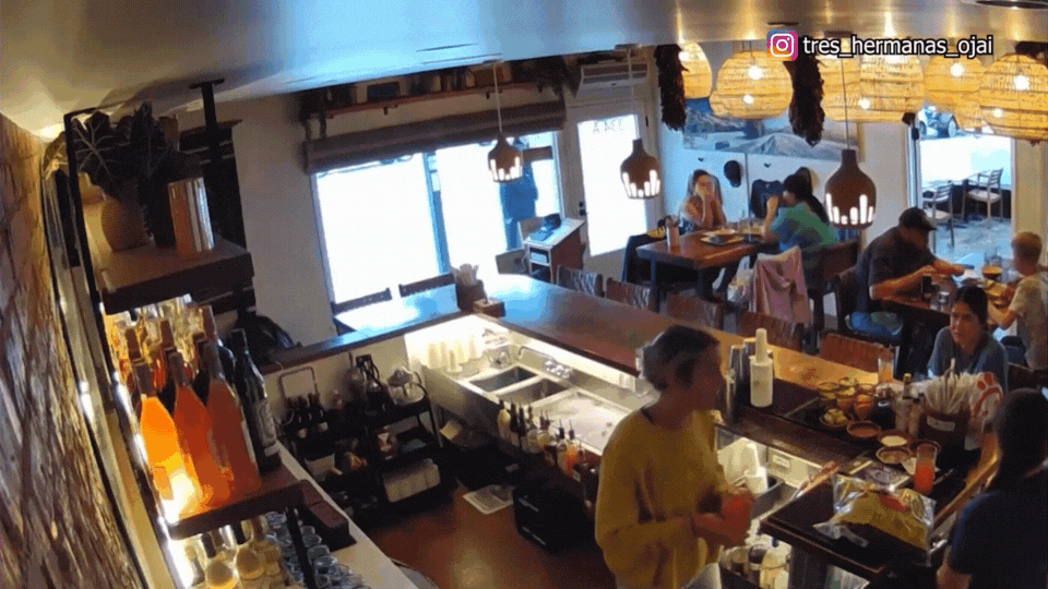
Video captured by a Ring camera in Oxnard showed wet roads reverberating during the quake, while a camera inside Tres Hermanas in Ojai showed bottles falling and shattering at the restaurant’s bar.
The Los Angeles Fire Department went into “earthquake mode” in which all 106 neighborhood fire stations conducted rapid infrastructure surveys in their districts. Areas of focus included transportation infrastructures, large gathering places, apartment buildings, and power lines, officials said.
A short time later, Los Angles Mayor Karen Bass announced no issues were found and no injuries were reported.
The Ventura County Sheriff’s Department said an aerial inspection of Lake Casitas Dam, Matilija Dam and the City of Ojai turned up no structural damage.
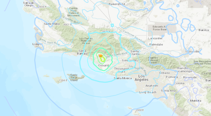
The 5.1 quake was followed by roughly two dozen aftershocks, including a magnitude 4.0 temblor and others reaching or exceeding 3.0.
“This is an area with a large concentration of faults but has not seen a lot of earthquakes over the 90 years that Cal Tech has been recording [them],” said seismologist Dr. Lucy Jones with the California Institute of Technology, adding that several “foreshocks” preceded the Ojai quake starting Saturday morning.
“Significant damage to a building would be extremely unlikely and it would only happen if you really had something wrong with your building,” said Jones. “I would imagine, just knowing what [magnitude] fives are in Southern California, that seeing some wine bottles tipped over at Trader Joe’s would be pretty likely,”
The National Weather Service said there was no tsunami threat.
The quake struck just as rain from Tropical Storm Hilary, the first tropical storm to hit California since 1939, began to intensify. The NWS issued Flash Flood Warnings for much of Los Angeles County, including areas where the quake was felt acutely.

Hundreds of earthquakes are recorded in California each year. Many are extremely minor, however, dozens measure over 3.0 magnitude. According to the California Department of Conservation, the strongest quake ever recorded in the Golden State measured 7.9 magnitude and struck Fort Tejon on Jan. 9, 1857.
This is a developing story. Stay with KTLA for updates.


