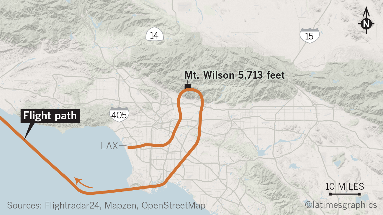
The Federal Aviation Administration is investigating an incident in which a passenger aircraft was given wrong directions by traffic controllers and guided toward the San Gabriel Mountains, where it flew just hundreds of feet higher than the peak of Mt. Wilson before turning around, according to publicly available flight data.
Bound for Taiwan, the EVA Air Boeing 777 took off to the east early Friday from Los Angeles International Airport’s south runway complex, according to FAA spokesman Ian Gregor. After takeoff, the air crew switched from the LAX control tower to the approach control operations in San Diego, which Gregor said was common practice.
“The air traffic controller at the approach control who was handling EVA instructed the pilot to make a left turn to a 180-degree heading,” he said. “She meant to tell the pilot to make a right turn to a 180-degree heading.”
Following the controller’s instructions, the pilot turned to the left.
Click here to read the full story on LATimes.com.