The wet weather has arrived! Southern Californians got a taste of what will follow this week as the first of two storms brought showers to the region Tuesday morning.
This first storm, expected to be the weaker of the two, dropped less than a tenth of an inch of rain overnight in most areas. La Cañada Flintridge did receive .20 inches and Northridge reached .13 inches, according to the National Weather Service.
“There are still some isolated areas of very light rain … some sprinkles, some mist across the Southland this morning,” KTLA 5 weather anchor Kirk Hawkins said.
Forecasters are already preparing for the next system, issuing a flash flood watch for all of Los Angeles And Ventura counties beginning Tuesday evening and continuing through late Thursday night.
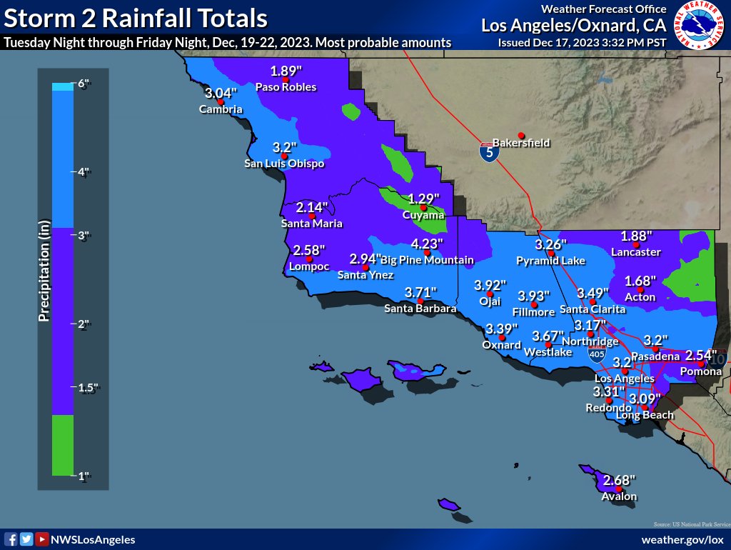
Rainfall estimates for most of Los Angeles County remain in the 2 to 4-inch range. The Weather Service shared the image below of the anticipated rainfall totals.
The second storm is expected to bring “several hours of steady moderate to heavy rain and gusty winds Wednesday and Thursday,” the Weather Service stated.
There will be a risk for flash flooding in the recent burn areas and drivers were urged to use extra caution due to slick roads and gusty crosswinds.
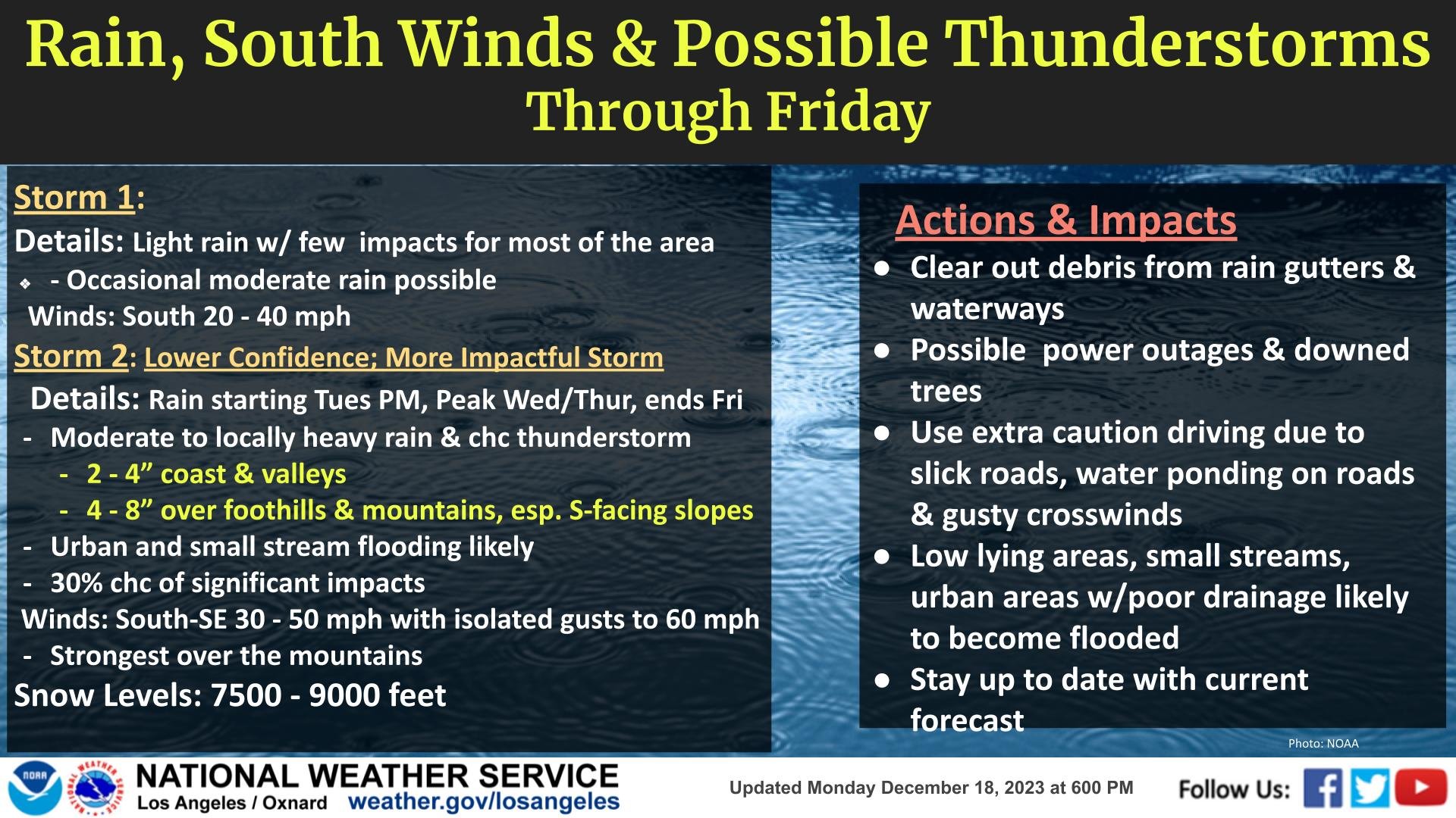
Snow levels are expected to remain quite high with these relatively warm systems.
Snow is expected at some of the higher resorts in the 7,500 to 9,000-foot range, according to the Weather Service.