While many areas of California are coping with the destructive impact of relentless rainfall, the news is nothing but good when it comes to the state’s snowpack.
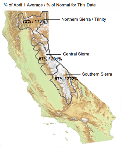
As of Monday, California’s snow water equivalent was 199% of normal for the date (January 9), according to the California Department of Water Resources.
The Southern Sierra was 222% of normal. The Central Sierra was 201%, while the Northern Sierra/Trinity was 173%.
“We are seeing the best start to our snowpack in over a decade,” DWR tweeted. “But it is only a start – most of the winter season has yet to unfold.”
Water experts are reluctant to signal too much optimism since last winter California also saw snow accumulate to above-average levels through December, only to see January, February and March become the driest on record.
“It’s great that we’ve been getting these storms, but we really can’t predict how long this will keep up,” Jeanine Jones, Interstate Resources Manager at DWR, told KTLA. “We are still significantly below the peak for the year as a whole, and that’s the goal we’re shooting for, not so much where we are right now.”
Jones also says the series of drenching rainstorms might be too much of a good thing.
“We’re happy that we’re getting snowpack and we’re happy that we’re getting these storms. But we would like them to be suitably spaced out so we’re not having the flood risk,” she said.
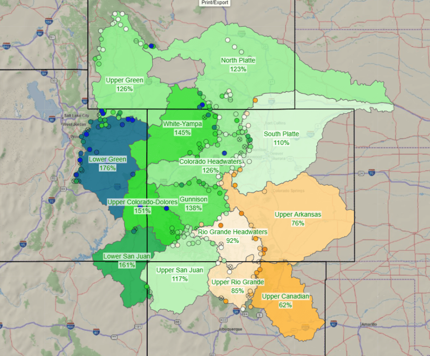
The snowpack outlook is also promising along the crucial Colorado River basins which feed Lake Powell and Lake Mead and is Southern California’s primary source of drinking water.
Snow water equivalent in the Rockies generally range from 117% to 176% of normal as of Monday.

