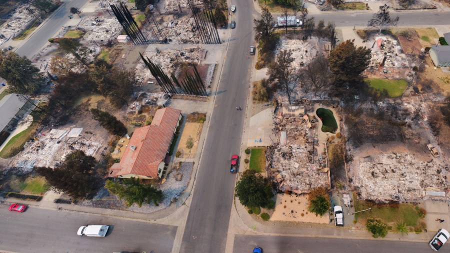
Newly released aerial images show the trail of destruction carved out by the Carr Fire as the flames tore through the Redding area recently.
The photos show panoramic views of the devastation left behind by the fire. They were taken from licensed drone pilots from a collective of various agencies, including the Menlo Park Fire District, Alameda County Sheriff’s Office, the Contra Costa Sheriff’s Office and the city of Redding.
The photos were released on the city of Redding’s website and were reported on by the Los Angeles Times.
Since erupting on July 23, the Carr Fire has charred more than 280 square miles in Shasta and Trinity counties, according to Cal Fire. It is 51 percent contained.
The blaze has destroyed more than 1,000 homes and 22 commercial buildings, making it the sixth most destructive wildfire in California history. An additional 191 homes and 26 commercial structures were also damaged.
Eight deaths have been associated with the fire, the most recent being a Cal Fire mechanic assigned to the blaze who died in a car crash Thursday morning.
The official cause of the blaze is mechanical failure of a vehicle, according to Cal Fire. Investigators said the rim of a flat tire scraped the asphalt of a road near Redding, creating sparks that ignited the deadly wildfire.
(Credit: Redding GIS) 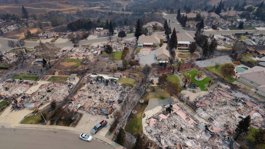
(Credit: Redding GIS) 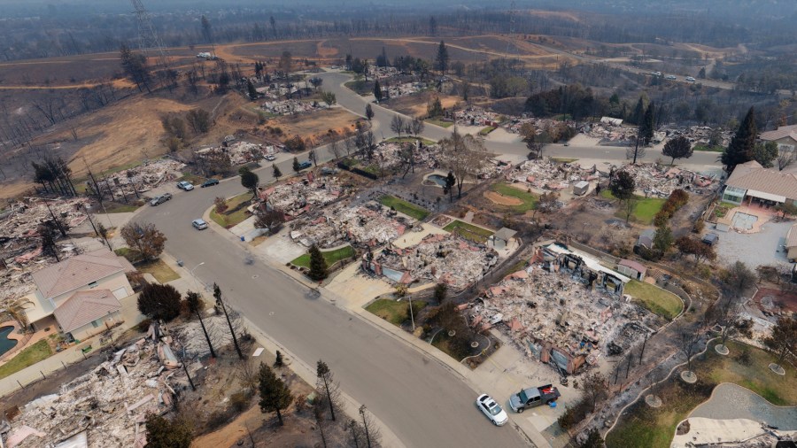
(Credit: Redding GIS) 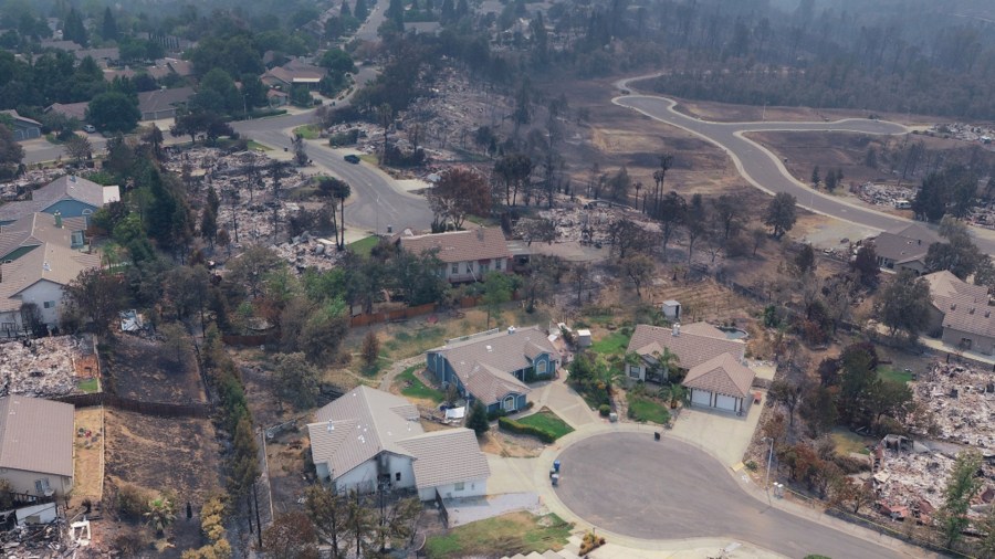
(Credit: Redding GIS) 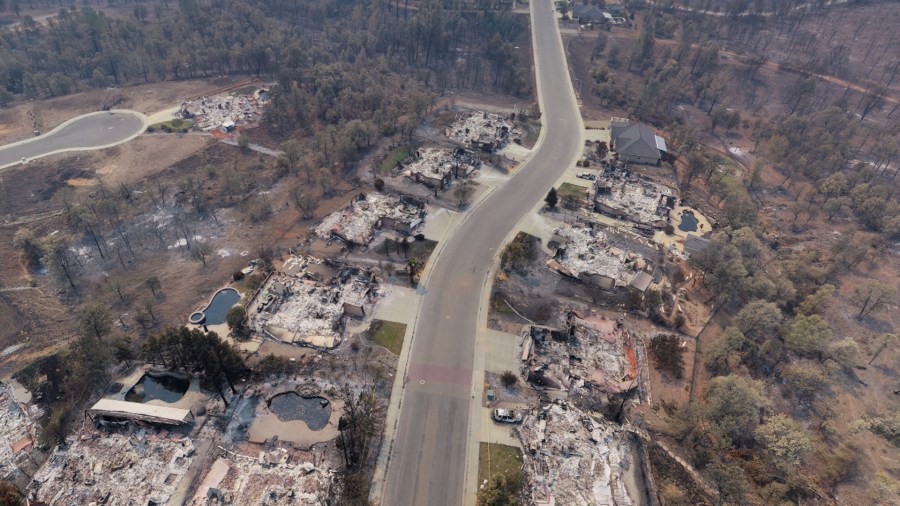
(Credit: Redding GIS) 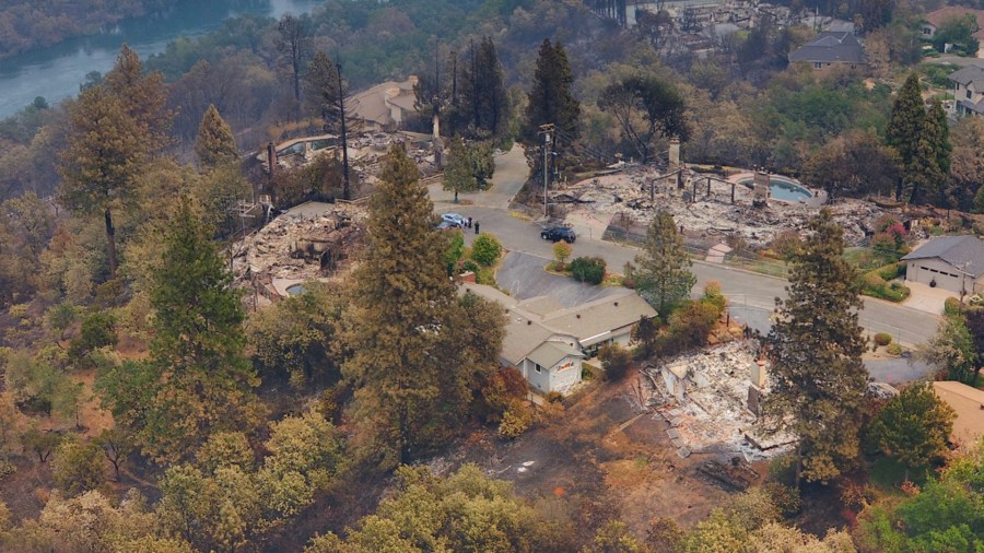
(Credit: Redding GIS) 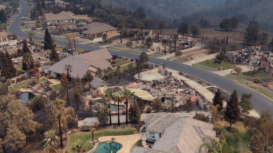
(Credit: Redding GIS) 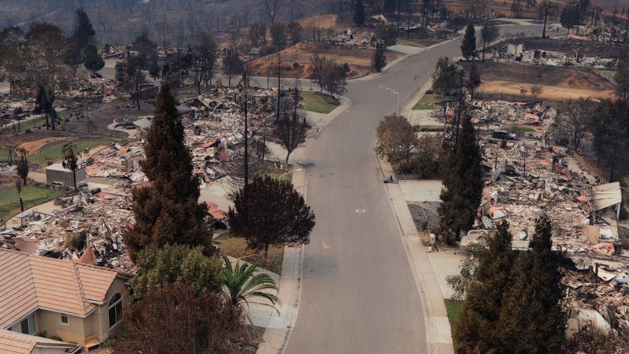
(Credit: Redding GIS) 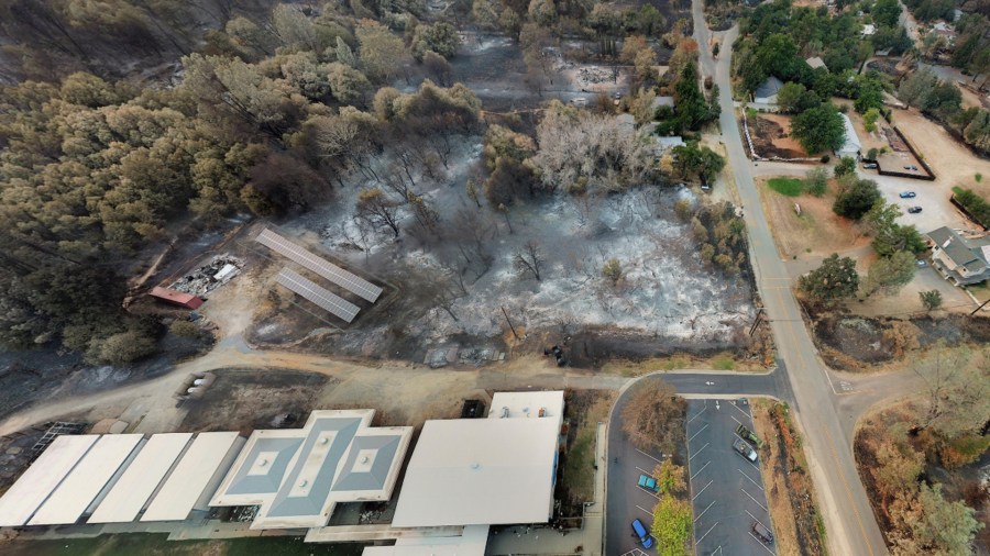
(Credit: Redding GIS) 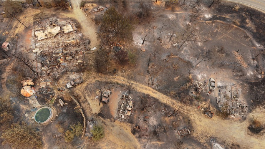
(Credit: Redding GIS) 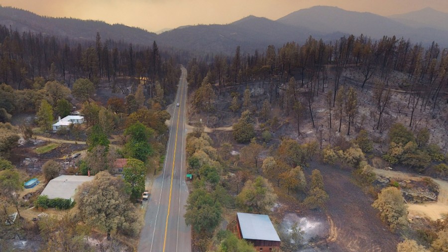
(Credit: Redding GIS) 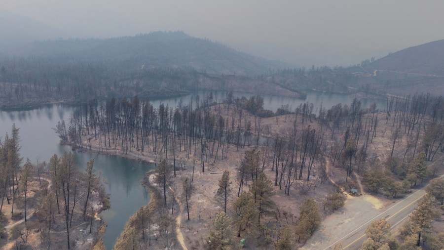
(Credit: Redding GIS) 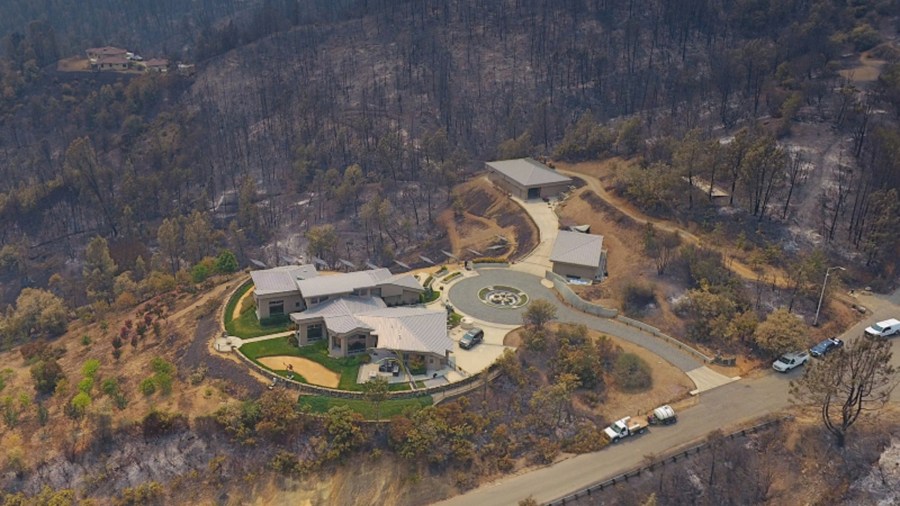
(Credit: Redding GIS) 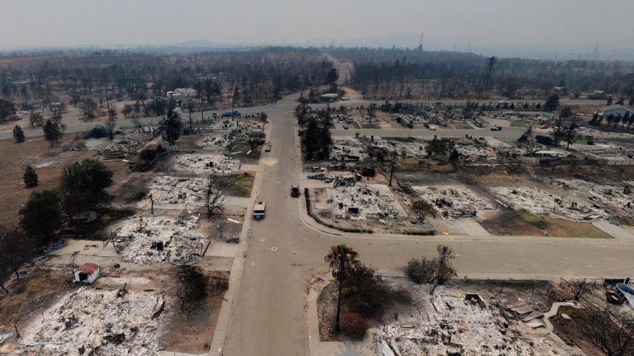
(Credit: Redding GIS) 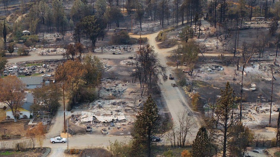
(Credit: Redding GIS) 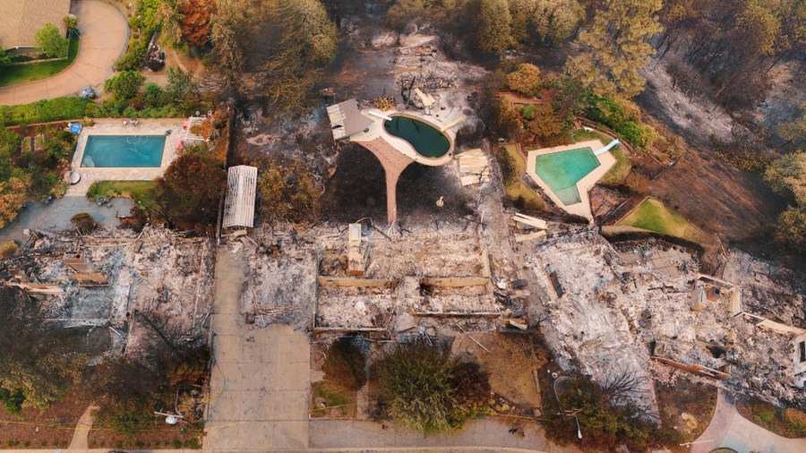
(Credit: Redding GIS) 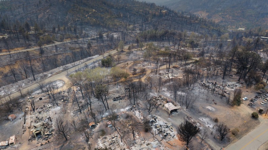
(Credit: Redding GIS) 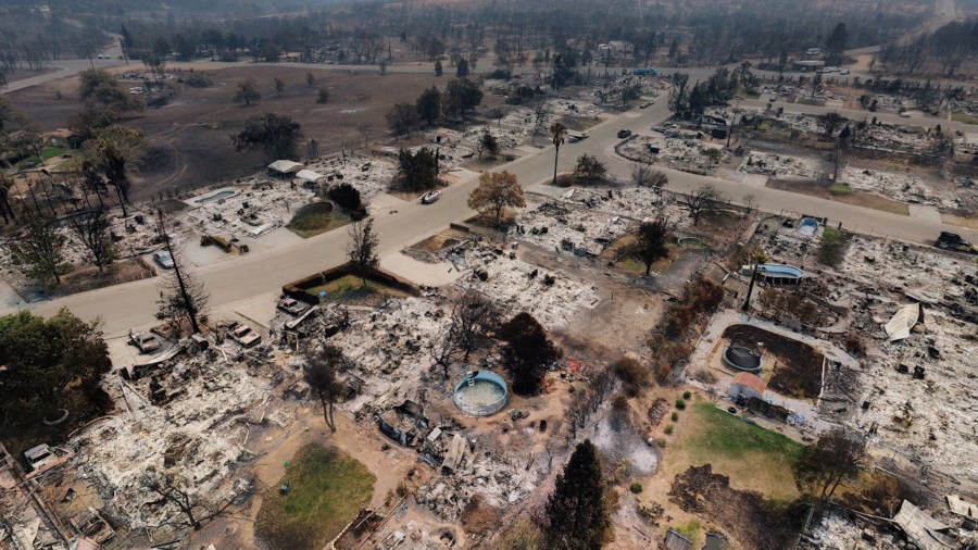
(Credit: Redding GIS)


