
The National Weather Service says it has received unconfirmed reports of a tornado touching down on the Central Coast of California Wednesday evening.
According to the National Weather Service in Los Angeles, the tornado may have touched down in San Luis Obispo County near the cities of Pismo Beach and Grover Beach.
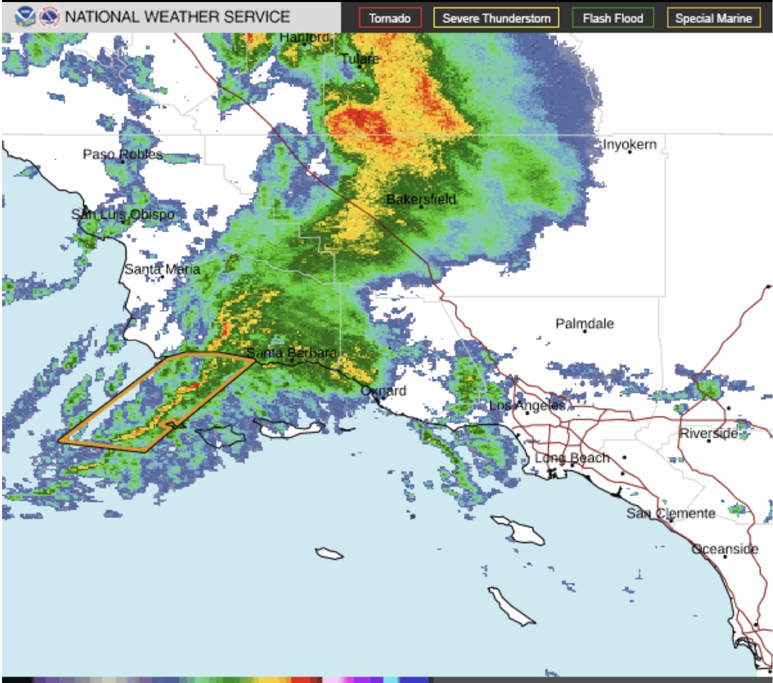
While NWS stressed the reports were unconfirmed as of 5:20 p.m., its meteorologists did say the area was “primed for severe convection.” Convection is a term used by NWS to describe “vertical transport of heat and moisture in the atmosphere, especially by updrafts and downdrafts in an unstable atmosphere.”
Officials warned anyone in the area of the Five Cities to seek shelter and expect heavy downpours, hail, lightning and strong winds.
That storm system brought similar warnings in Southern California Wednesday evening. Radar imagery showed a “strong convection” spreading east of Point Conception on the Gaviota coast that was expected to move eastward through the evening as it entered Ventura and Los Angeles counties.
That storm brought potential of wind gusts up to 60 mph, nickel-sized hail, brief heavy downpours and the possibility of tornadoes, NWS said.
Since 2000, there has been only one confirmed report of a tornado touching down in San Luis Obispo County. That weather event happened on Feb. 2, 2004, in Oceano, another of the Five Cities.
That tornado was described as a waterspout that “developed offshore of Oceano Dunes” and then came onshore as an F0 tornado, according to its National Oceanic and Atmospheric Administration storm incident report.
The weak twister hit a park ranger in his truck. The ranger was uninjured and his truck sustained “no reportable damage.”


