This is an archived article and the information in the article may be outdated. Please look at the time stamp on the story to see when it was last updated.
Stunning drone photographs of Lake Oroville help illustrate the drought emergency declared by Gov. Gavin Newsom in two Northern California counties.
Water levels at Lake Oroville have dropped to 42% of its 3,537,577 acre foot capacity.
Conditions are particularly acute in Mendocino and Sonoma counties because the local water supply depends on rainfall in the Russian River watershed.
The second parched winter in a row has left the region’s reservoirs in even worse shape than during the severe 2012-16 drought. The major water district has warned that Lake Sonoma and Lake Mendocino could reach historically low levels by October.
Read the full story on LATimes.com.
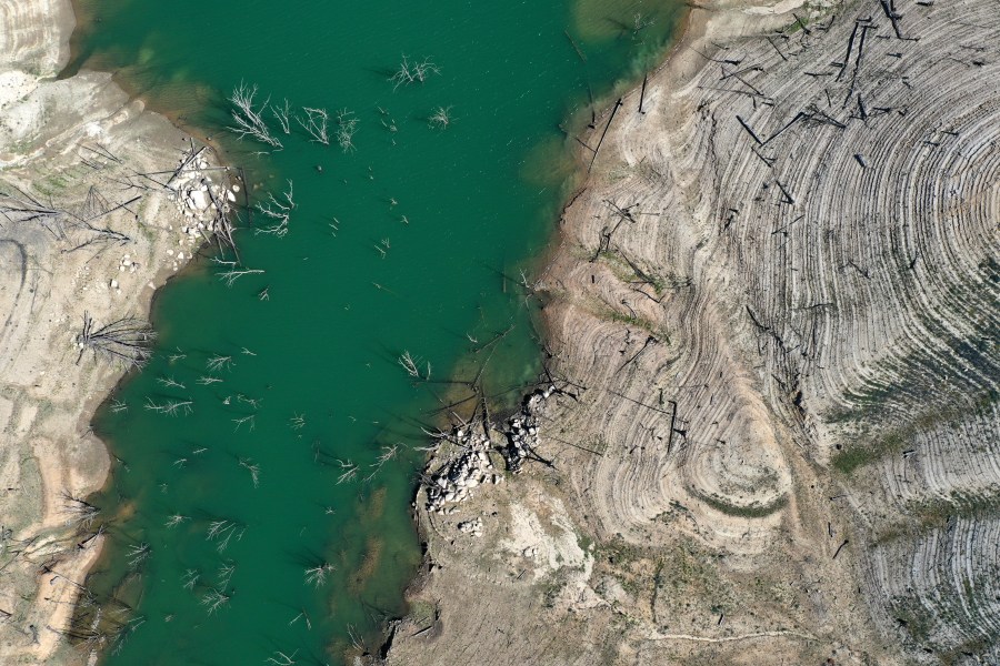
In an aerial view, low water levels are visible at Lake Oroville on April 27, 2021 in Oroville. (Justin Sullivan/Getty Images) 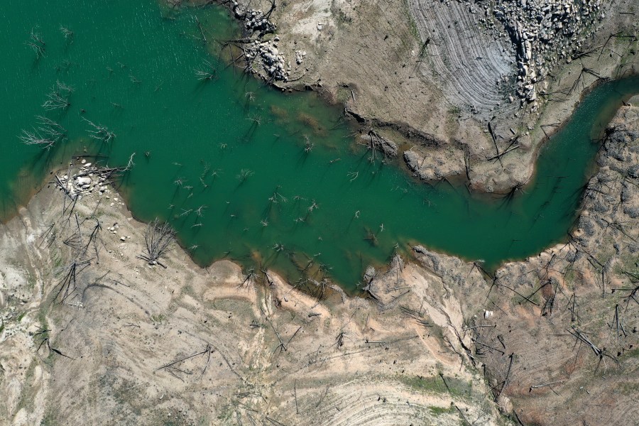
In an aerial view, low water levels are visible at Lake Oroville on April 27, 2021 in Oroville. (Justin Sullivan/Getty Images) 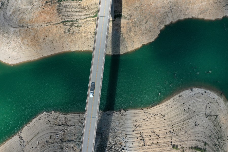
In an aerial view, a truck drives on the Enterprise Bridge over a section of Lake Oroville on April 27, 2021 in Oroville. Justin Sullivan/Getty Images) 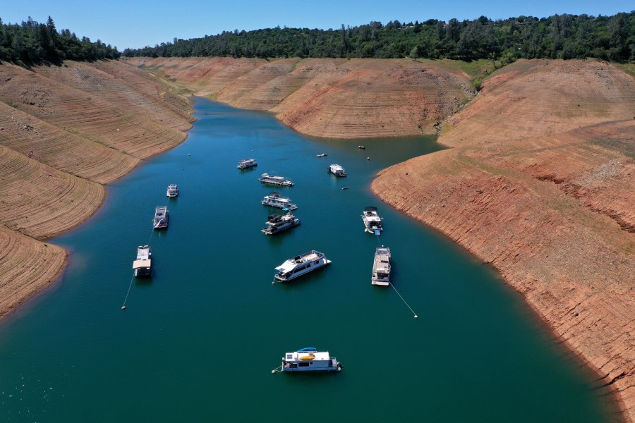
In an aerial view, houseboats are dwarfed by the steep banks of Lake Oroville on April 27, 2021 in Oroville. (Justin Sullivan/Getty Images) 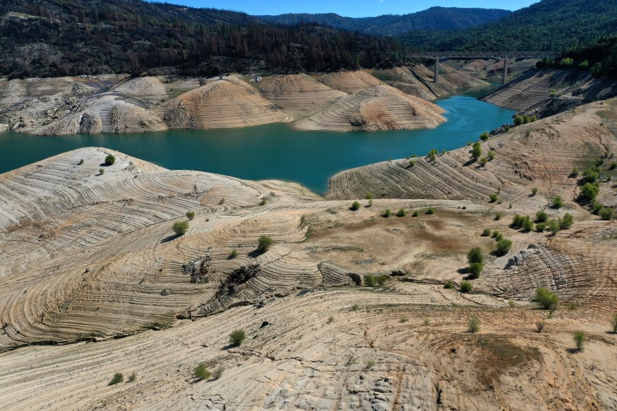
In an aerial view, low water levels are visible at Lake Oroville on April 27, 2021 in Oroville. (Justin Sullivan/Getty Images) 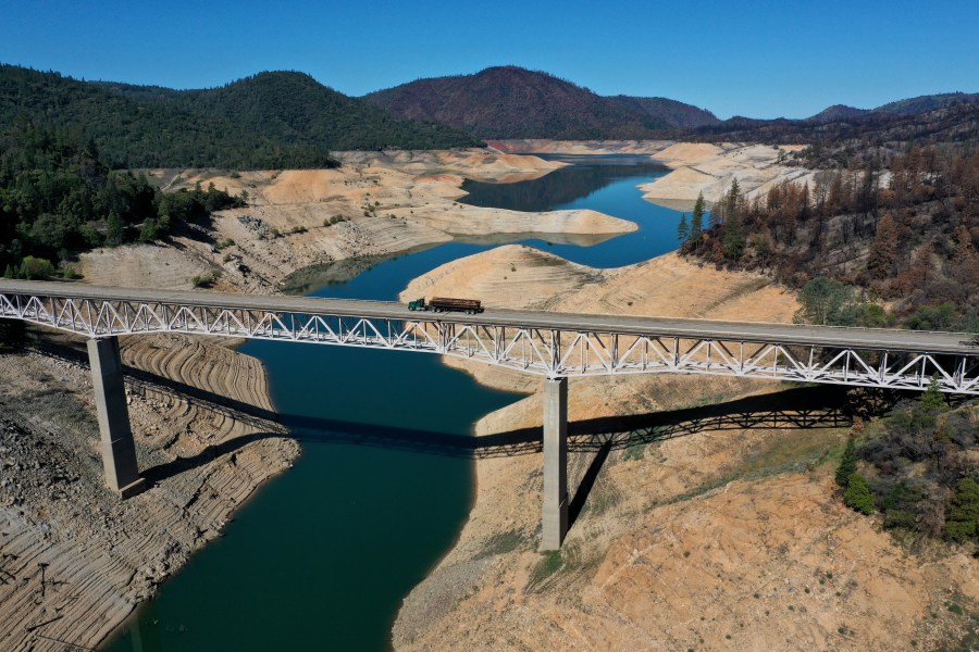
In an aerial view, a truck drives on the Enterprise Bridge over a section of Lake Oroville on April 27, 2021 in Oroville. (Justin Sullivan/Getty Images) 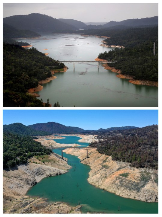
In this composite image a comparison has been made between an aerial view of California when the state’s severe drought emergency was lifted in 2017 (top) and a week after California Gov. Gavin Newsom declared a drought emergency in two counties in 2021 (bottom). (Justin Sullivan/Getty Images)


