What started out as a relatively dry winter in Southern California has taken a sharp turn with the arrival of an atmospheric river that drenched the region with one storm this week and is about to deliver another.
As of late January, metro Los Angeles was pacing behind its average rainfall totals for the water year, which began on October 1 and ends on September 30.
With Thursday’s deluge, downtown L.A. has now received 6.77 inches of rain – generally in line with the average for this time of year, meteorologist Rose Schoenfeld with the National Weather Service told KTLA 5 News.
“With the next storm, we should shoot up above normal for this time of year,” Schoenfeld said.
Central L.A. received around 1.5 inches of rain, while more than two inches fell in Orange County, the San Fernando Valley, and coastal Ventura County on Thursday, leading to isolated flooding and mudslides.
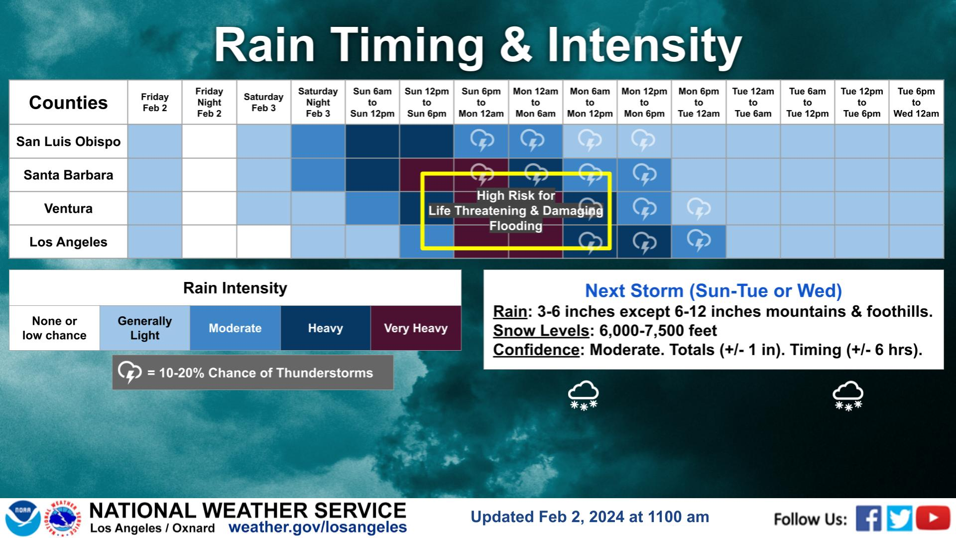
The next storm is expected to dump three to six inches of rain on Southern California’s coastal areas and valleys and up to 12 inches in the foothills and mountains Saturday night into Tuesday.
“When it rains, it pours. That was the case last year, and that seems to be the case this year as well,” said Schoenfeld.
The weather service has already issued flood watches for much of California, including the Southland, Central Coast, Central Valley and San Francisco Bay Area.
The NWS says the most intense rainfall will hit metro L.A. from Sunday night into Monday.
Schonfeld urges Californians to prepare by clearing out gutters, ensuring they are prepared in case of an evacuation and avoiding parking in low-lying areas ahead of the storm.