A cold storm system is moving through Southern California that will deliver rain and snow through Sunday morning, along with potentially damaging winds.
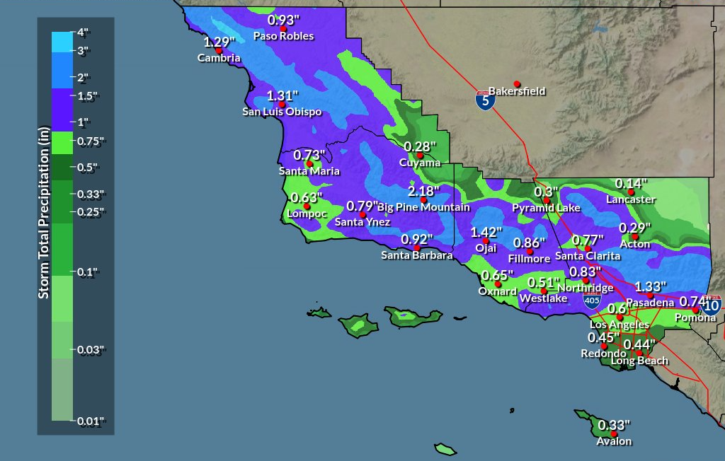
According to the National Weather Service, precipitation will be mostly light but long in duration.
Coastal areas and valleys in Los Angeles, Ventura, Orange, Riverside and San Bernardino counties can expect 0.5 inch to 1 inch of rainfall, with up to 3 inches possible in the foothills and mountains.
Daytime high temperatures will be in the mid-to-upper 50s to low 60s through the weekend.
Snowfall amounts will vary based on elevation with 6-12 inches expected above 6,500 feet, 3-6 inches between 5,500-6,500 feet, 1-2 inches between 4,500-5,500 feet and a dusting of snow along the 5 Freeway through the Grapevine.
“Probably the biggest impact of this storm will be the wind,” the Weather Service said. “The strongest winds look over all mountains and interior valleys/deserts where downed trees, power outages, and hazardous driving conditions will be prevalent.”
High wind warnings have been issued for Apple and Lucerne valleys, mountains and deserts where southwest winds of 35-45 mph are expected, with gusts up to 80 mph.
The NWS has also issued winter storm warnings for the mountains in Riverside and San Bernardino counties.
Dry and cool weather follows the storm, but meteorologists say there is another chance of rain in Southern California’s forecast for the middle of next week.
“At this point, it looks as though it would only bring light precipitation to the area,” the Weather Service said.


