A cold winter storm that is expected to bring another inch or so of rain to Southern California is moving in for the weekend.
This is already a major storm for Northern and Central California due to the atmospheric river conditions, which we dealt with here in the Southland during previous events, KTLA Meteorologist Henry DiCarlo said.
The atmospheric river will not play much of a role in Southern California as we catch the tail end of the system.
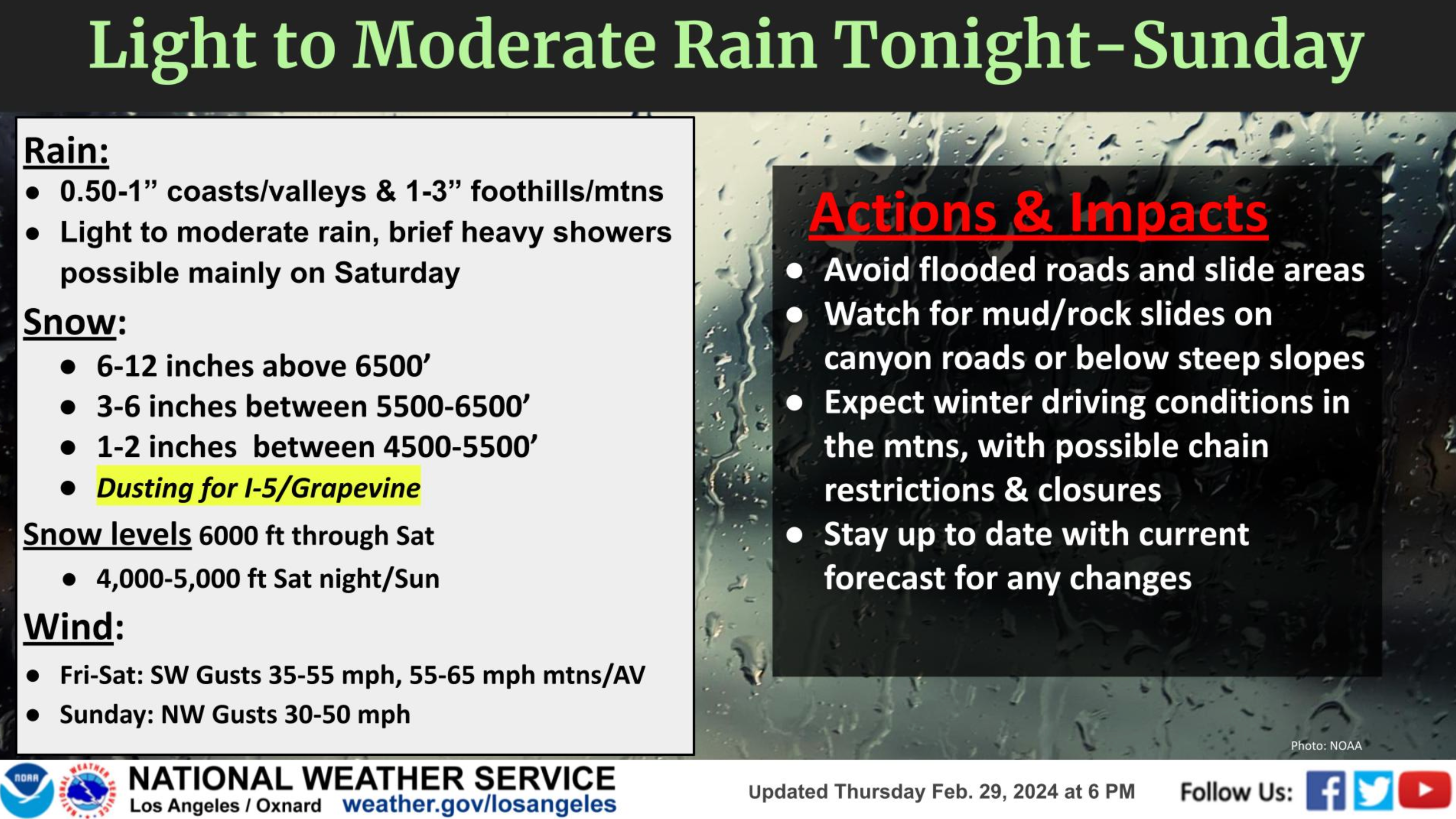
The National Weather Service is calling for about a half-inch to an inch of rain to fall on the coastal and valley areas through Sunday.
Foothill and mountain areas should see between one and three inches of rain, according to the Weather Service.
“We can handle it. That’s a typical winter storm that brings us measurable rain,” Henry said. “Compared to our prior two big atmospheric river storms this will not be a big deal for us.”
While some light rain will fall on Friday, the brunt of the storm is not expected to arrive until Saturday afternoon.
“We should be in the midst of the widespread rain about midday tomorrow through tomorrow evening,” Henry said.
This storm is expected to be much colder than the systems that pushed through the region in February.
A winter storm warning is in effect for the Eastern San Gabriel Mountains, including the cities of Mount Wilson, Mount Baldy, Wrightwood and the Angeles Crest Highway from 6 p.m. Friday through 10 a.m. Sunday.
A winter weather advisory is in effect for the San Bernardino County Mountains, including the cities of Big Bear City and Big Bear Lake from 10 p.m. Friday through 6 a.m. Sunday.
About a foot of snow is expected to fall above the 6,500-foot mark. Snow levels may drop to around 4,000 feet by Sunday morning with a dusting of snow possible along the Grapevine, according to the Weather Service.
Forecasters are also calling on the storm to impact local surf conditions.
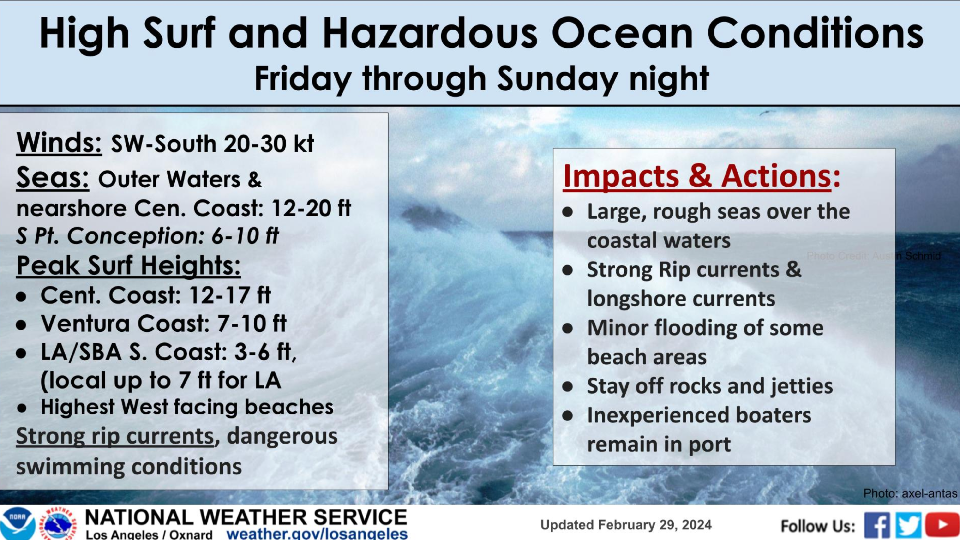
Seven to 10-foot surf is expected to arrive Friday through Sunday along the Ventura County coasts.
Los Angeles County can expect 3 to 6-foot surf with local sets up to 7 feet.
Forecasters are also warning beachgoers about strong rip currents that will make for dangerous swimming conditions.


