After a rainy Easter weekend, forecasters say Southern Californians can enjoy a warming trend through Wednesday, though more rainfall is expected as early as Thursday night.
As the weak to moderate cold storm makes its way into the Southland, temps are expected to keep rising, peaking at or near 80 degrees Wednesday in the warmest valleys, the National Weather Service reports.
Near advisory level winds could be a factor in some interior and coastal regions on Thursday, along with increasing cloud cover and noticeably cooler temps.
With the most recent storm dropping between one and three inches of rain across Southern California, weather officials are predicting the brunt of this next system to hit late Thursday evening into Friday, though only about a half inch of precipitation is expected in valleys and coasts.
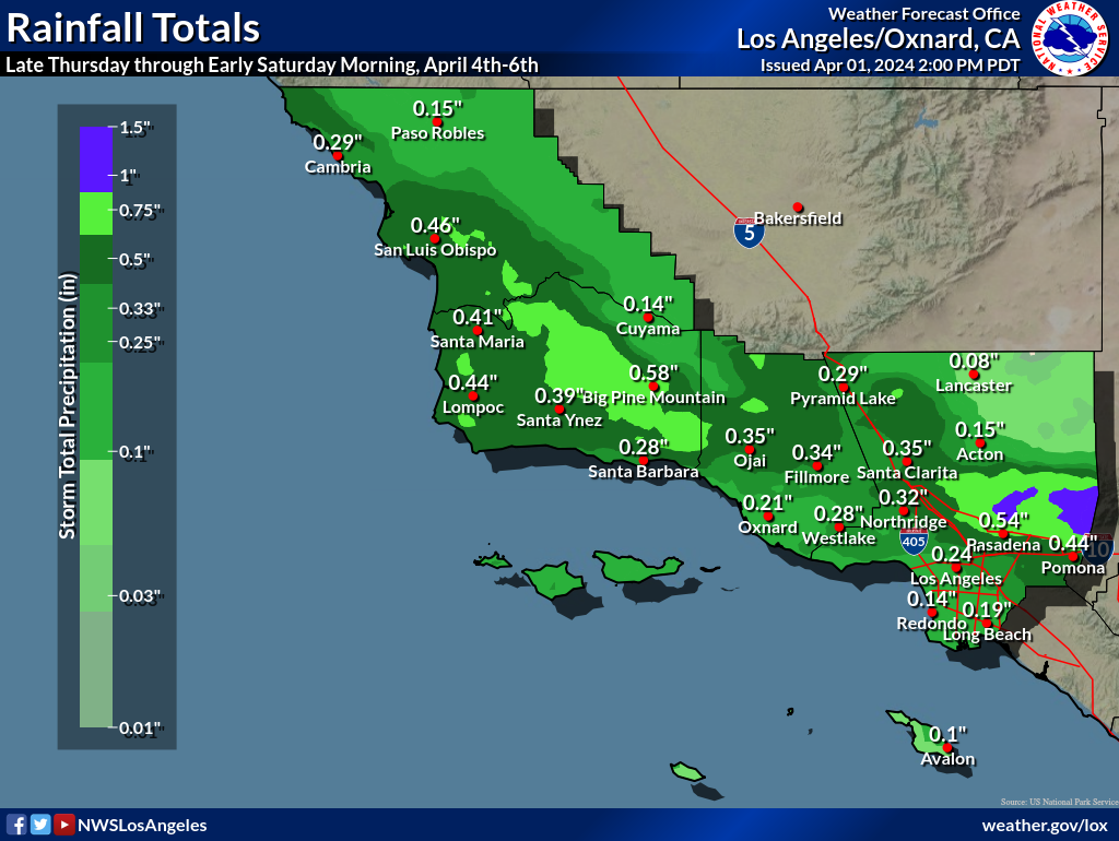
West facing mountain and foothill communities could see up to an inch of rainfall.
There is also a small chance, about 10%, that thunderstorms could be seen on Friday during the peak of the storm.
Snow levels are likely to plummet to around 3,000 feet, with the cold storm bringing the possibility of one to three inches between 3,500-4,500 feet. At 5,000 feet and higher, snowfall of between three to eight inches is likely.
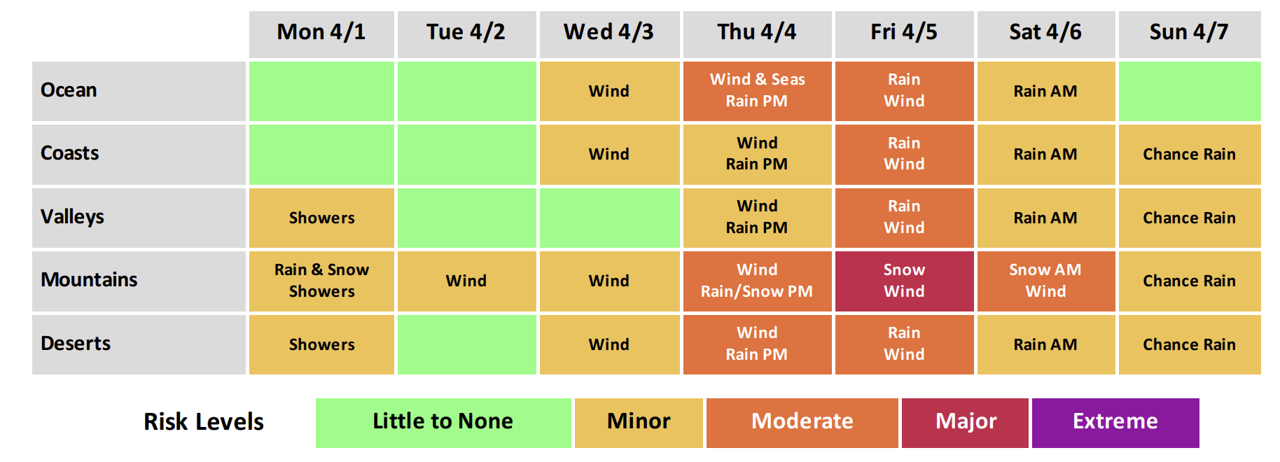
“Now is the time to start planning for possible winter driving at these elevations during this timeframe, which may include the I-5 corridor near Tejon Pass, Highway 14 through Acton, and the Antelope Valley foothills,” NWS said.
Breezy conditions on Friday are expected to make daytime temps in the 50’s feel even cooler.
“[The storm] is going to be in and out pretty quickly, which means we’re not going to see much on Saturday and Sunday,” KTLA Meteorologist Vera Jimenez said. “At least at this point, it looks like a dry weekend.”
Daytime temps Saturday through Monday should remain in the mid-to-high 60’s with periods of sunny skies and cloud cover.


