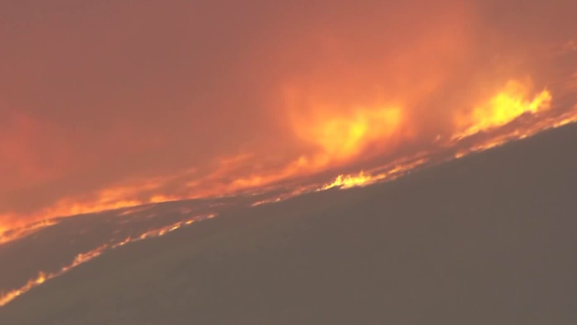
A massive wildfire burning in Santa Barbara County that has already scorched thousands of acres likely will not be fully contained until the middle of next week, officials said Saturday.
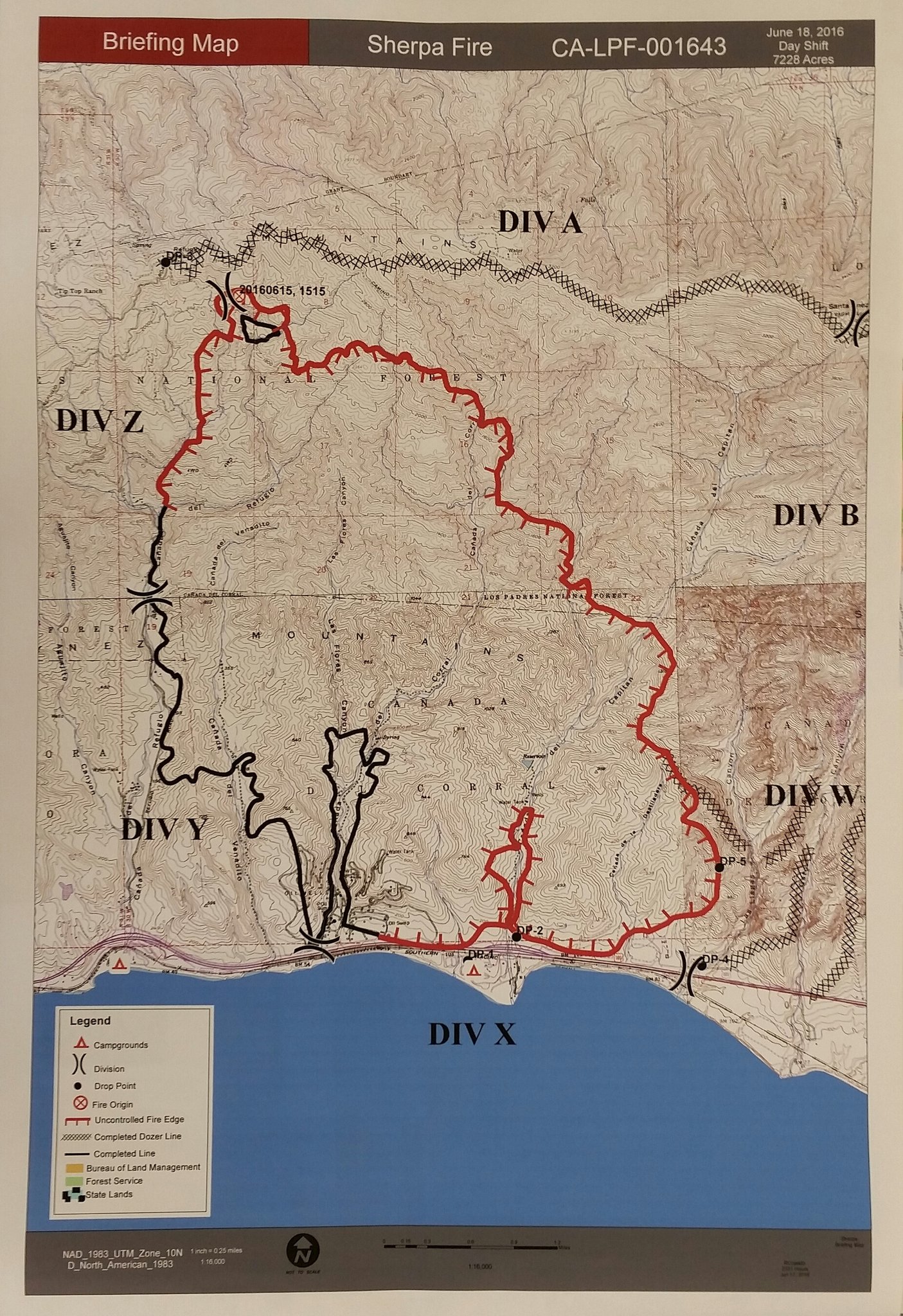
The so-called “Sherpa Fire” has burned approximately 7,811 acres, according to the latest estimate from county officials, provided shortly after 5 p.m.
Crews appeared to be making steady progress against the blaze, which was 45 percent contained by 11:30 a.m., a Santa Barbara County fire official tweeted. Earlier in the morning, containment was estimated at 24 percent.
Some 270 structures remained threatened, and more than 400 evacuations contacts were made, according to the federal InciWeb page for the wildfire. Authorities were unsure exactly how many residents and campers have been evacuated.
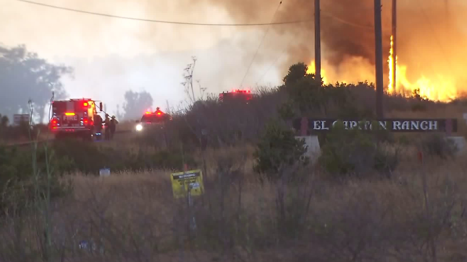
Mandatory evacuations have been ordered in Refugio Canyon, Canada del Venadito Canyon, Las Flores Canyon, El Capitan Canyon, El Capitan Ranch, El Capitan State Beach and Canada de la Destiladera.
Evacuation warnings are also in effect for Las Llagas Canyon, Gato Canyon, Las Varas Canyon, Dos Pueblos Canyon and Eagle Canyon.
An evacuation center has been set up at the Wake Center, located at 300 North Turnpike Road in the Goleta area, according to the InciWeb page. Large animals can be taken to the Earl Warren Show Grounds, which is on 3400 Calle Real, off of Highway 101.
Residents should heed mandatory evacuation orders and be prepared to leave at a moment’s notice, county Sheriff Bill Brown warned on Friday.
CORRECTED: Estimated Perimeter Map #SherpaFire State beaches re-labeled. pic.twitter.com/cP3WHCNUW8
— Santa Barbara County (@countyofsb) June 19, 2016
“This is still a very dynamic fire situation and we do not want residents … to be complacent,” Brown said. “Even though conditions may appear to have become better during the day, the reality is things can change … very rapidly in the evening. We do not want our residents to have a false sense of security.”
Highway 101, a major throughway along the Central Coast, was temporarily shut down because of the fire, but has since been reopened. However, stretches of the roadway may be closed again if conditions change, according to the InciWeb site.
More than 1,900 firefighters are battling the massive blaze, which broke out west of Goleta near Refugio Road on Wednesday afternoon and prompted a local emergency to be declared less than 48 hours later.
The fire is primarily fueled by brush and tall grass chaparral in an area that hasn’t burned for more than 65 years, according to a county news release.
“It is ominous. We are concerned because the fuels out there are drought-stressed. There’s a lot of tree mortality out there that makes fire behavior worse,” Santa Barbara County Fire Department Chief Eric Peterson said.
California is also in its fifth year of drought, which is “making an already pretty volatile situation not any better,” he added.
Weather conditions, including erratic and extreme winds, have aided in the fire’s spread, officials said. Additional rounds of sundowner winds are expected through the weekend, with the strongest gusts occurring between 8pm and midnight, according to the InciWeb page.
In addition to gusty sundowners, crews will face extreme heat, with temperatures expected to rise into the 90s.
Air-quality warnings were expected to be in effect for the southern areas of Santa Barbara County through the weekend.
Smoke from the fire was also impacting air quality in Los Angeles and Orange counties, according to regional air regulators.
The latest estimate of full containment of the Sherpa Fire is by Thursday, according to the InciWeb site. Earlier, fire officials said they did not expect it to be fully contained until next Saturday.
One firefighter was injured in the blaze after sustaining a minor laceration, the county news release stated. A water treatment building at El Capitan state beach was also destroyed.
The cause of the fire has not yet been determined.
KTLA’s John A. Moreno contributed to this report.