Southern California is bracing for potential wind and flood damage from Hurricane Hilary, which is expected to be downgraded to a tropical storm by the time it arrives in the region on Sunday.
In the Los Angeles metropolitan area, the National Weather Service is projecting wind gusts of 39 to 73 miles per hour, depending on your location. The map below shows the official wind threat risk. (view interactive map)
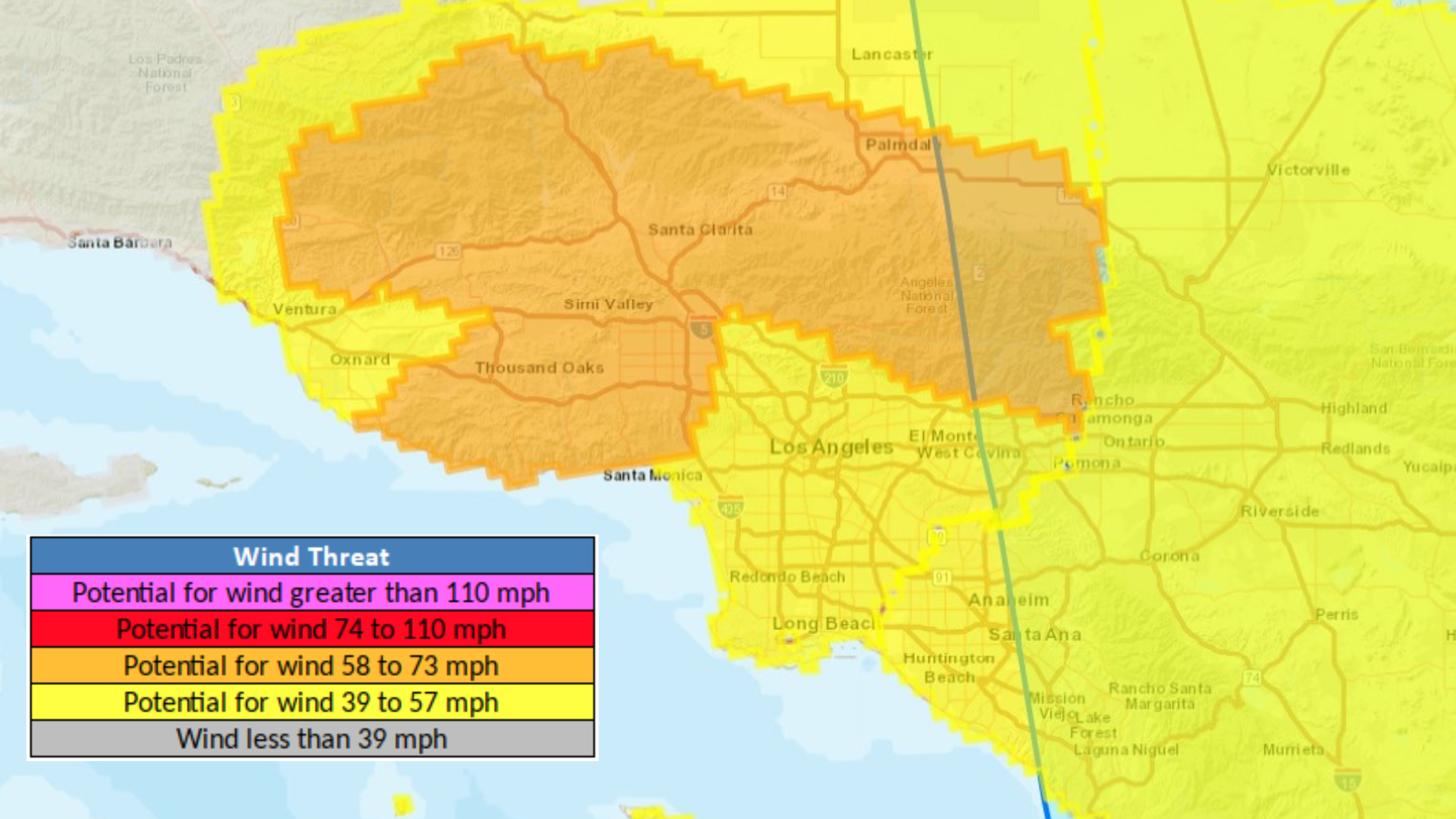
Areas in orange can expect peak winds of 58 to 73 miles per hour. They include:
- Northridge
- Woodland Hills
- Van Nuys
- Chatsworth
- Fillmore
- Piru
- Santa Paula
- Westlake Village
- Palmdale
- Lancaster
- Lake Los Angeles
These winds are capable of toppling trees and causing damage to roofing and siding materials, along with damage to porches, awnings, carports, and sheds, NWS said. Scattered power and communications outages are also possible.
Areas in yellow, which include central Los Angeles, the San Gabriel Valley, Orange County and much of the Inland Empire can expect peak winds of 39 to 57 mph, NWS said. The potential damage is largely the same.
Sustained winds of 25-35 mph are expected in both areas.
Southern California is under the first tropical storm warning in history through Monday. Hilary will be the first tropical storm to hit California since September 25th, 1939.


