New satellite images show the smoke from wildfires that’s drifted 600 miles into the Pacific Ocean, and made California’s air quality plummet to “very unhealthy” and “hazardous” levels.
There are currently 26 major fire incidents in the state, according to Cal Fire. The largest right now are the LNU and SCU Lightning Complex fires.
Those two fires, burning north and south of the greater Bay Area, are affecting roughly 226,100 acres.
Widespread air quality index measurements in the “very unhealthy” (AQI 201-300) and “hazardous” (>300) range are being seen in Central and Northern California, including the greater San Francisco Bay area and Central Valley, according to Environmental Protection Agency measurements.
“These levels are rare in the Bay Area, and even healthy adults can experience immediate health impacts from short term exposure to these levels of fine particulate pollution,” Erin DeMerritt of the Bay Area Air Quality Management District told CNN. “Exposure to wildfire smoke can irritate the eyes and airways, causing cough, a dry scratchy throat, and irritated sinuses,” DeMerritt added, “it can trigger wheezing in those who suffer from respiratory illnesses.”
Southern California residents were also urged to limit outdoor activity, due to smoke from the Lake and Ranch 2 fires.
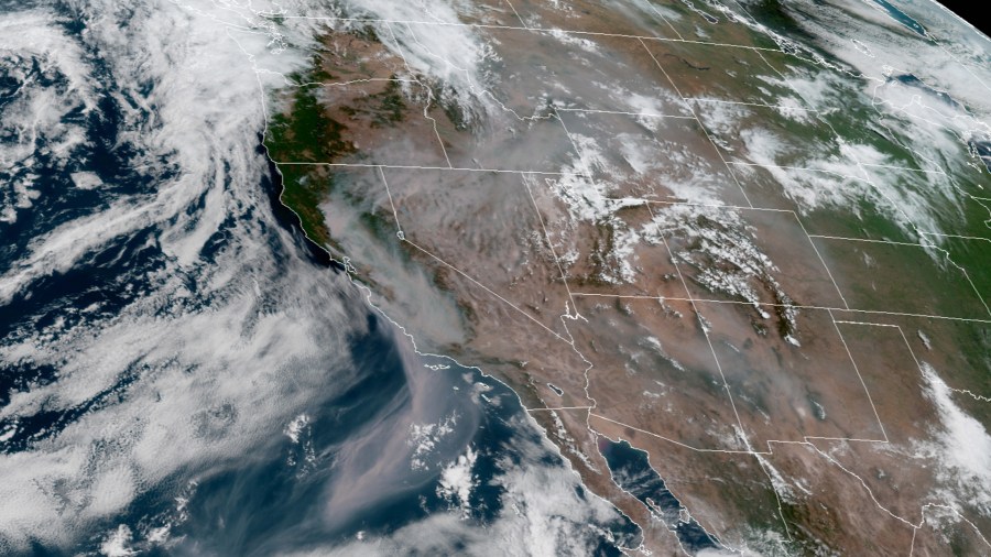
Smoke from the fires can be seen in NASA satellite images taken on Wednesday. It appears much of the smoke is being sucked out into the Pacific Ocean.
The smoke trail stretches southwest off the California coast. Satellite imagery taken by NOAA also shows the smoke being pulled from California and into the Pacific.
Residents in portions of Lake and Napa counties were advised that there was an “immediate threat to life and property.” They were urged to evacuate as soon as possible, according to Cal Fire. Some Sonoma County residents were also asked to evacuate.
Today, red flag warnings continue to be posted in California, in addition to Montana, Idaho, Utah and Colorado, where other large fires are burning.
Smoke from the fires is prompting air quality alerts in the San Joaquin Valley in California.


