This is an archived article and the information in the article may be outdated. Please look at the time stamp on the story to see when it was last updated.
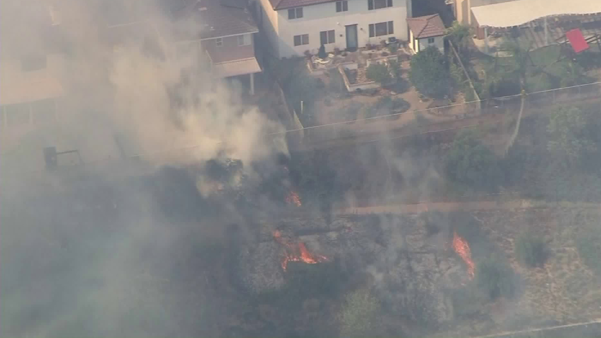
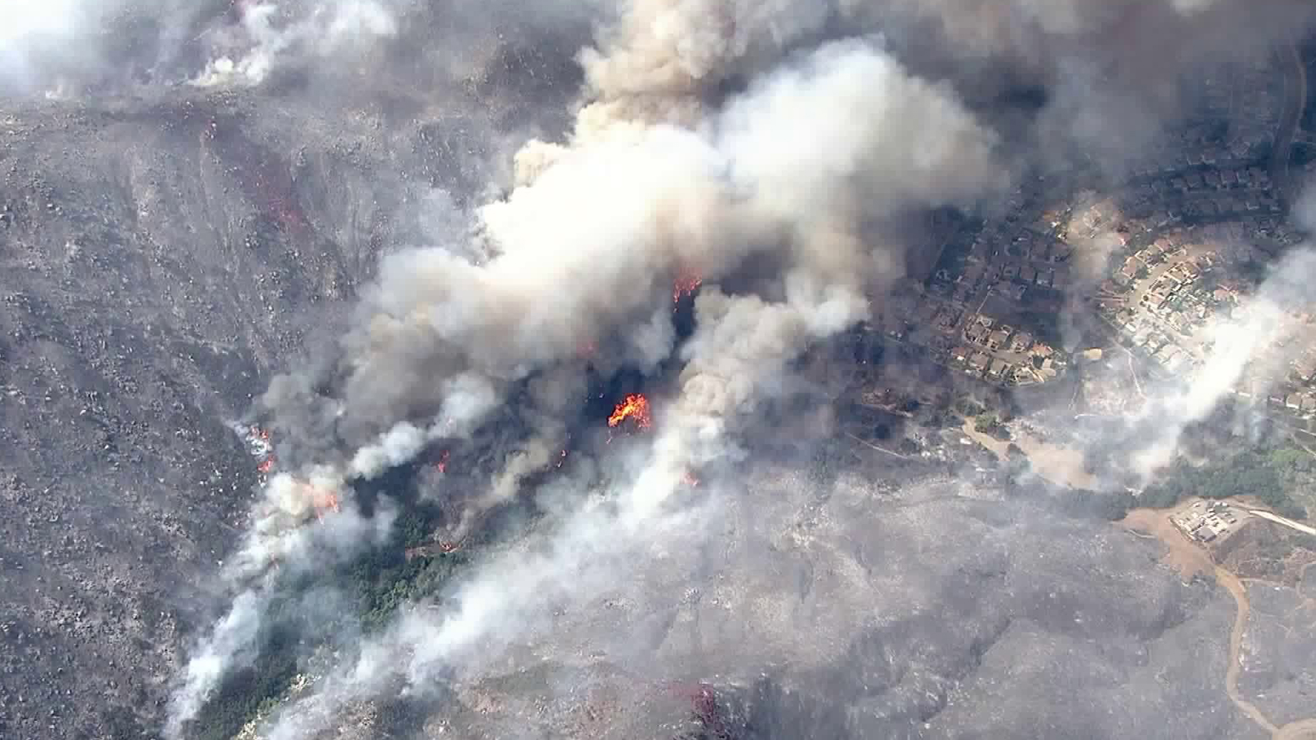
New evacuation orders were issued in Murrieta as a brush fire flared up on Thursday afternoon, burning dangerously close to some homes and threatening at least 2,000 residences in the area, officials said.
Flames from the Tenaja Fire rage in the Murrieta area on Sept. 5, 2019. (Credit: KTLA)
The increase in fire activity came as winds whipped up the flames mid-afternoon, increasing the total acreage of the Tenaja Fire to just shy of 2,000 acres, according to Cal Fire Riverside. It was 10% contained as of 5:30 p.m. The new evacuation orders issued around 2 p.m. were for residents on the following streets: Montanya Place; Botanica Place; Belcara Place; and Lone Oak Way. “People on these streets must go now because it is the safest time to leave,” a Cal Fire news release stated. Riverside County has released a detailed map on its website showing the areas that have been evacuated. Click here for a complete list of evacuations and school and road closures.  
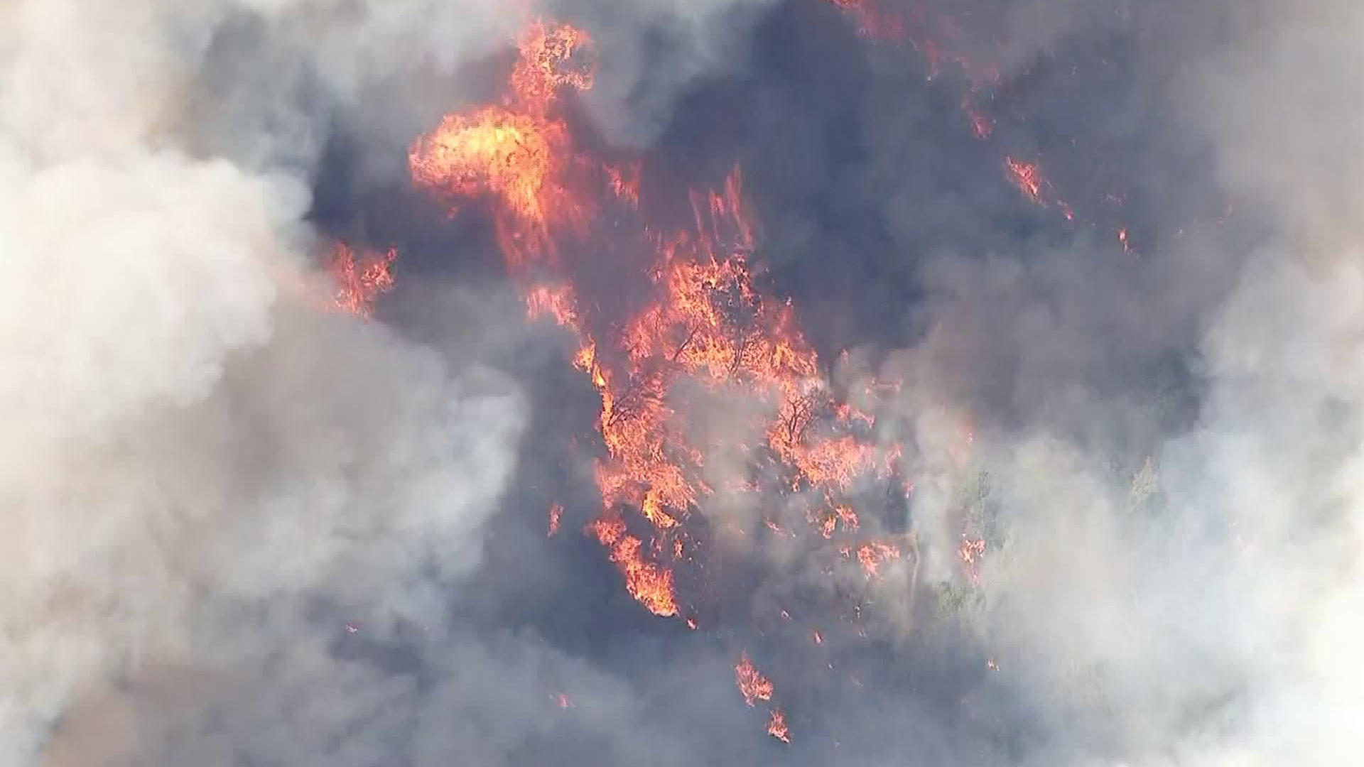
About 570 homes have been evacuated, Murrieta Police Chief Sean Hadden said in an evening news briefing. Of those, residents of 141 had elected to shelter in place — although most had made that decision Wednesday night and may have evacuated Thursday, Hadden said. “We understand residents want to get back into their homes,” the police chief said. “But now is not the time, because it’s a very dangerous situation.” There haven’t been any reports of looting, according to Hadden. Around 2 p.m., Cal Fire Capt. Fernando Herrera told KTLA the flames were heading toward the bottom of canyons. “The fire itself is burning into the Copper Canyon area, into the lower elevations,” he said. He noted the fire is burning in a westerly direction, toward La Cresta and the Bear Creek area.
Firefighters beat back flames as they burned dangerously close to homes in Murrieta on Sept. 5, 2019. (Credit: KTLA)
The flames were burning precariously close to a community as helicopters battled by the blaze by air around 2:30 p.m., Sky5 video over the scene showed. Firefighters in one backyard could be seen using hoses to beat back the flames. A rear corner of another home was singed by the fire, though crews were able to prevent it from spreading. They could be seen dousing water on the side of the residence shortly before 4 p.m. Two homes suffered minor damage, Murrieta Fire and Rescue Chief David Lantzer said, though he did not have information on where those houses were. Tall columns of thick smoke were also being blown toward residences, hampering visibility in the area. The plume generated pyrocumulus clouds that were visible at least 40 miles away, according to the National Weather Service. “Our biggest concern right now is obviously the city of Murrieta along the foothills. This is where most of our residents are, on top of the Santa Rosa Plateau area. Our main goal is to protect life and property,” said Cal Fire Capt. Richard Cordova. Firefighters had a critical state along the fire line in the foothills where the fire came down through the canyon area, he explained. That held the fire to the roadside, away from the neighborhood. The steep terrain has made it difficult to access active burn areas as the flames are propelled forward by wind and topography, said Cal Fire Battalion Chief Todd Hopkins. Adding to that trouble has been a shifting wind pattern known by firefighters as the “Elsinore effect,” Hopkins said. “The winds will come out of one direction in the morning — blowing out toward the ocean — and then by the afternoon we’ll get an 180-degree switch in the wind direction,” he said. “The fire will tend to start burning downhill and start coming back into neighborhoods. That’s what we’ve seen for the past few days.”
The Tenaja Fire burns dangerously close to homes in the Murrieta area on Sept. 5, 2019. (Credit: KTLA)
Just over 800 firefighters have been sent to battle the blaze, both on the ground and from above in air tankers and helicopters. “We’re just trying to hit this thing hard so we can control it and get the residents back into their neighborhoods,” Cordova said. The fire is being fanned by stronger winds with gusts of up to 20 to 30 mph, Herrera said. Temperatures climbed to 97 degrees early in the afternoon before dipping slightly, according to the weather service. Humidity was at about 37%. The forecast called for isolated showers and thunderstorms in the area, with the chance of precipitation estimated at 20%. Crews may do controlled burns later Thursday to help mitigate the threat, he added. Similar weather conditions are expected Friday, Hopkins said, but the goal is to increase the blaze’s containment by Friday morning. Aerial video Thursday evening appeared to show decreased fire activity, with flames burning in smaller patches further away from homes. The blaze was reported just before 4 p.m. Wednesday near the intersection of Tenaja Road and Clinton Keith Road in the La Cresta community. A smoke advisory was issued by the South Coast Air Quality Management District Wednesday evening and was expected to continue at least through Friday. Gusty winds from the southwest were expected to carry smoke into the Inland Empire. Those in Riverside County who have not registered for emergency alerts can do so by going to the RivCoReady website, officials said. The cause of the fire has not been determined. KTLA’s Erika Martin contributed to this story. Check back for updates on this developing story.