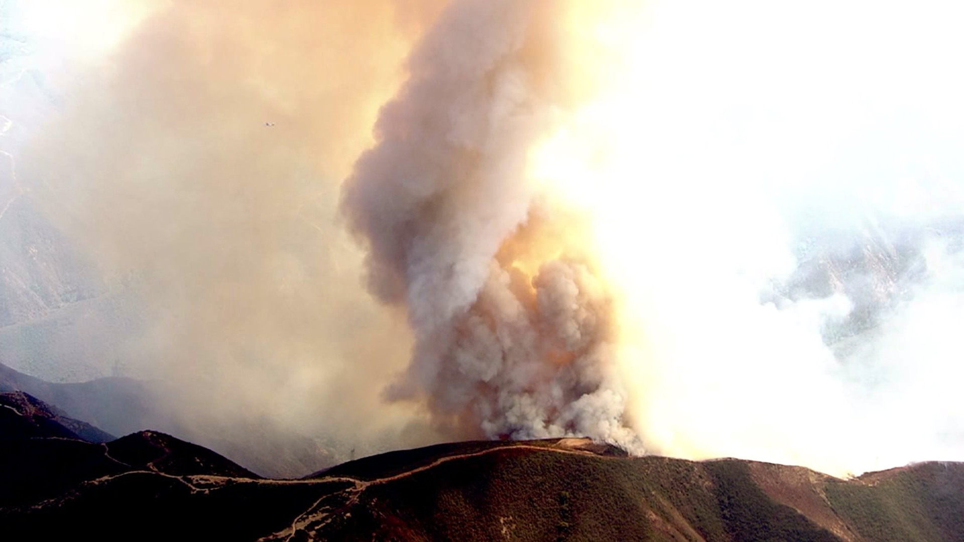
As temperatures soared Friday, a brush fire burning in the mountains of Cleveland National Forest south of Corona grew to 1,600 acres, sending a plume of smoke towering above Silverado Canyon that was visible from miles away.
Mandatory evacuations started at 6 p.m. for the area from 30331 Silverado Canyon Road east to the end of the canyon, authorities. That order was issued in part because of expected nighttime downslope winds that could push the flames into populated areas in the canyon bottom, Battalion Chief Mike Petro said.
Brush left very dry by the state’s historic drought had created heavy fuels that were burning in a rugged area, Petro said. The blaze was burning about in a remote part of the Santa Ana Mountains about 40 miles southeast of downtown Los Angeles.
The Silverado Fire was first reported shortly before 11 a.m. near the 30500 block of Silverado Canyon Road (map), according to Orange County Fire Authority spokesman Larry Kurtz.
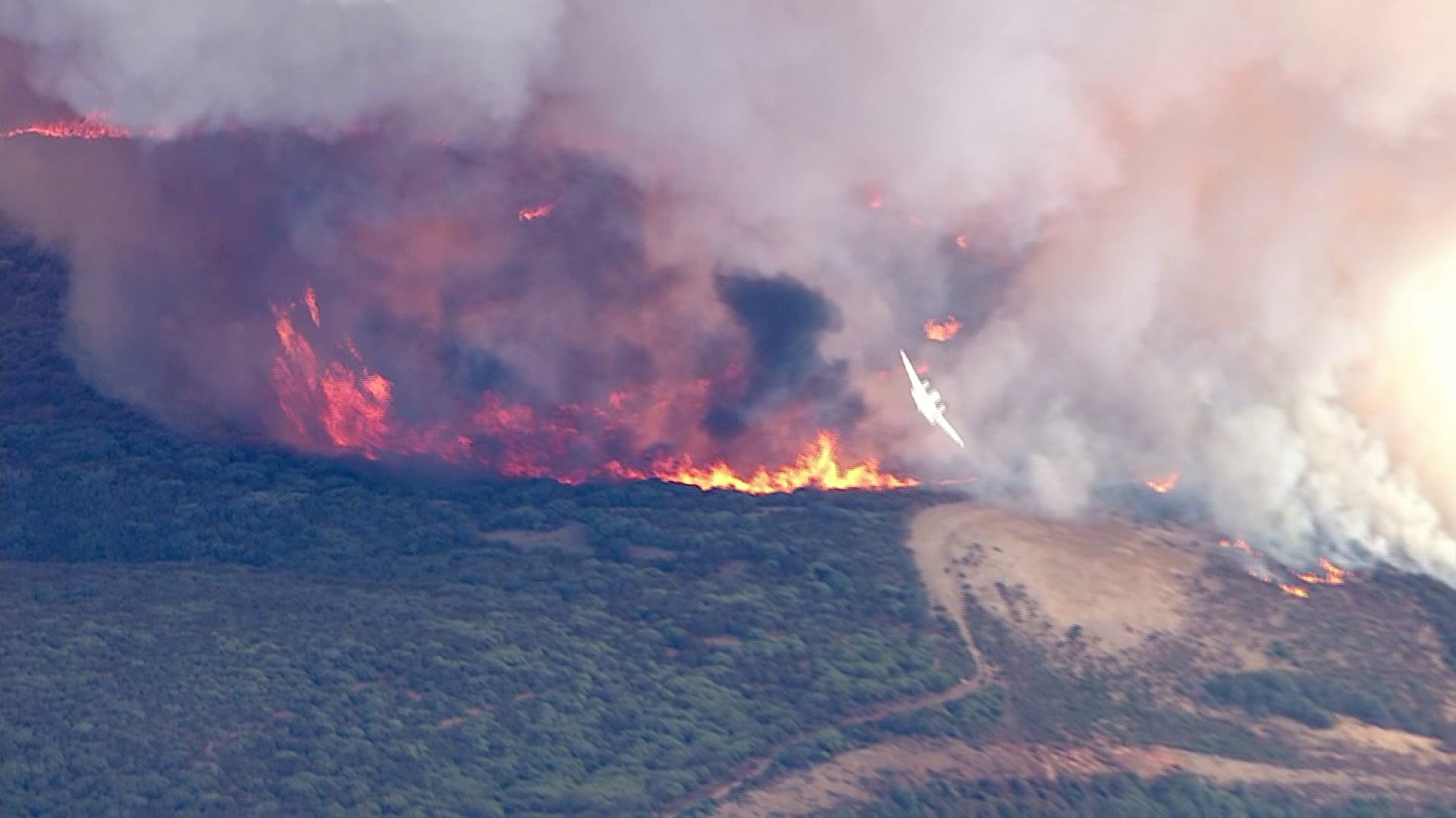
The fire was burning in medium to heavy vegetation and was moving at a “high rate of speed,” Kurtz said.
One firefighter had a minor heat-related injury, Petro said.
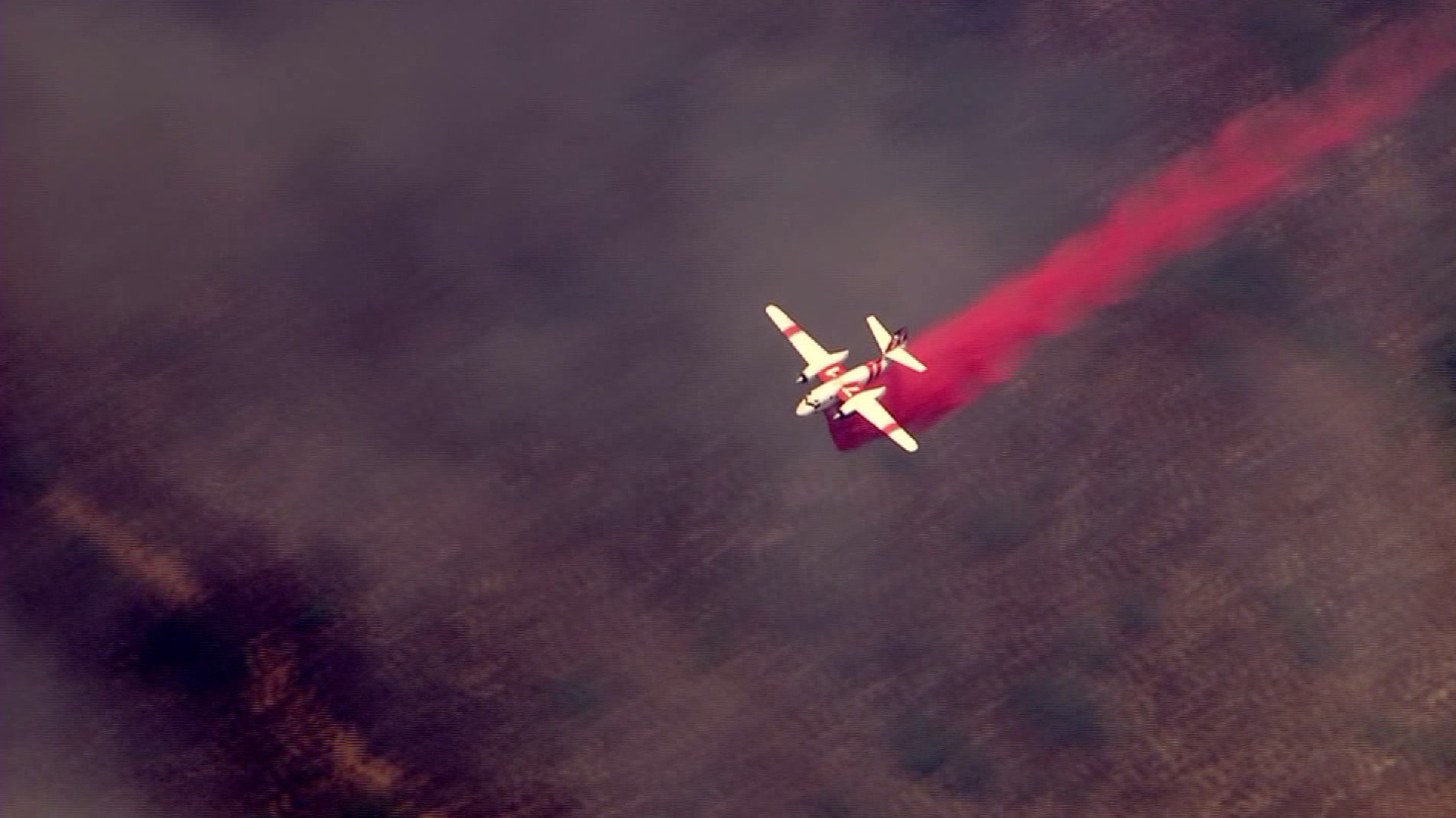
A little over four hours after it began, the blaze was exhibiting “extreme fire behavior,” the Corona Fire Department stated on Twitter, saying a very large air tanker, or a “VLAT,” had been ordered.
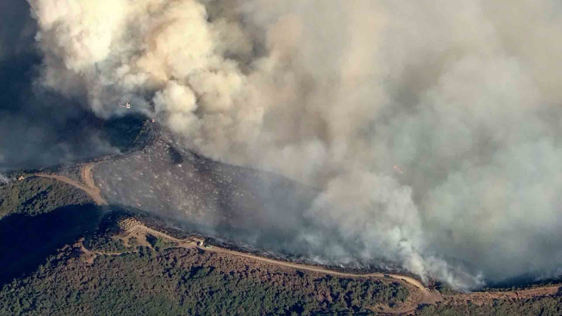
It grew to 1,600 acres by about 7 p.m., with no containment time or percentage estimated, according to a subsequent tweet from the department. The fire’s forward spread was stopped at the intersection of Main Divide Road and Bedford Motorway (map) but was still spreading to the east, Corona fire officials said.
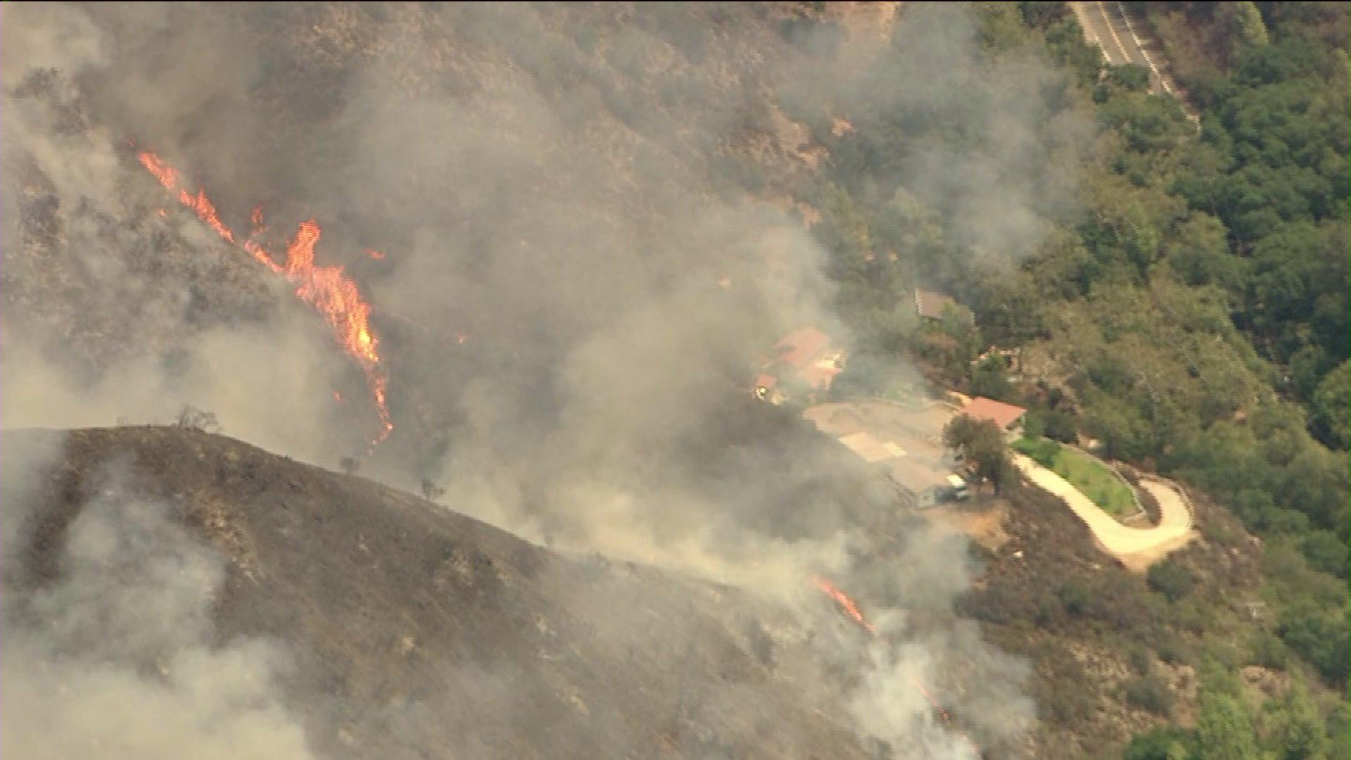
Hillsides were blackened and coated in ash below crews that tried to keep the burn area from spilling over ridges, aerial video from Sky5 showed in early evening.
No structures were threatened, authorities said.
However, aerial video over the scene showed the flames initially appearing to creep up on a cluster of structures in the remote, scenic canyon.
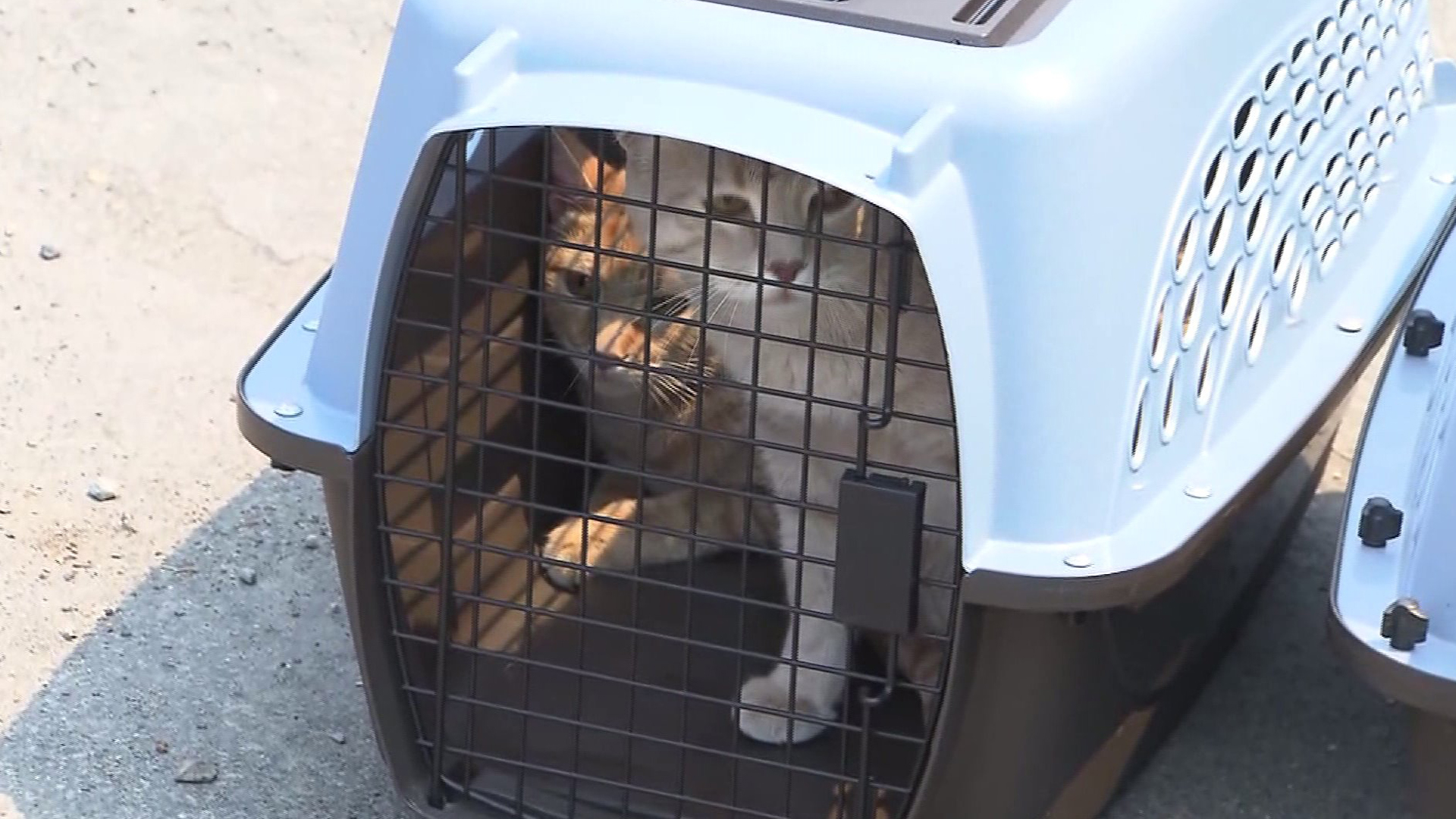
Shortly after the fire broke out, a woman who lives in the canyon told KTLA that some residents in the area were voluntarily leaving their homes.
The resident reported that the flames were quickly getting closer to homes. Some residents had gathered their pets and were leaving the area.
“A neighbor called and said, ‘Have you seen the fire? … Look outside your house,’ and it was right behind the house,” recalled resident Robert, who chose to leave his home along with his wife and dog. “We immediately just grabbed ourselves, our passports and few valuables and ran.”
Her described the area as “quite rural,” and said it had not burned in a “long time.”
Modjeska Canyon, one canyon over, was devastated in the 2007 Santiago Fire, which destroyed homes.
Authorities said the eastern flank of the fire was in a rugged, difficult to reach area.
A “reception center” was opened El Modena High School, 3920 E. Spring St. in Orange, for residents who were not able to return home due to the fire.
Silverado Canyon Road was closed, as was Santiago Canyon Road between the 241 Toll Road and Live Oak Canyon Road.
A portion of Silverado Canyon Rd was set to reopen only to residents at 2 p.m., the Sheriff’s Department stated on Twitter. Residents living east of 30311 Silverado Canyon Road were not being allowed in as of 2 p.m., according to a post on the federal interagency website InciWeb.
Cal Fire was assisting the U.S. Forest Service and O.C. Fire Authority in battling the brush fire.
Six fixed-wing aircraft and five helicopters were working on the blaze, Petro said about 6:30 p.m. About 280 people were working on fire, he said.
The temperature in the area early in the afternoon was around 88 degrees, while humidity was at 34 percent, according to the National Weather Service. Winds were lightly blowing in a west northwest direction at 10 mph.
A high of 105 degrees was predicted on Saturday for the Silverado Canyon area. The National Weather Service issued a heat advisory for the area from 10 a.m. Saturday to 7 p.m. Monday.
Residents as far away as Los Angeles and Riverside counties reported seeing plumes of dark smoke from the Silverado Fire.
A smoke advisory was issued by the South Coast Air Quality Management District for areas where smoke was impacting the surface. Unhealthy air quality was likely to be experienced in the Saddleback Valley area, parts of the Corona/Norco area, part of the Lake Elsinore area and the Capistrano Valley area, according to AQMD.
The cause of the fire was not immediately known.
Those with questions about the Silverado Fire were asked to call the OC’s Public Information Hotline at 714-628-7085.
KTLA’s Tony Kurzweil and Jennifer Thang contributed to this article.
Correction: The name of Orange County Fire Authority Battalion Chief Mike Petro was spelled incorrectly in an earlier version of this report. The story has been updated to reflect the proper spelling.
More Video:


