Showers have arrived in Southern California as residents prepare for New Year’s weekend.
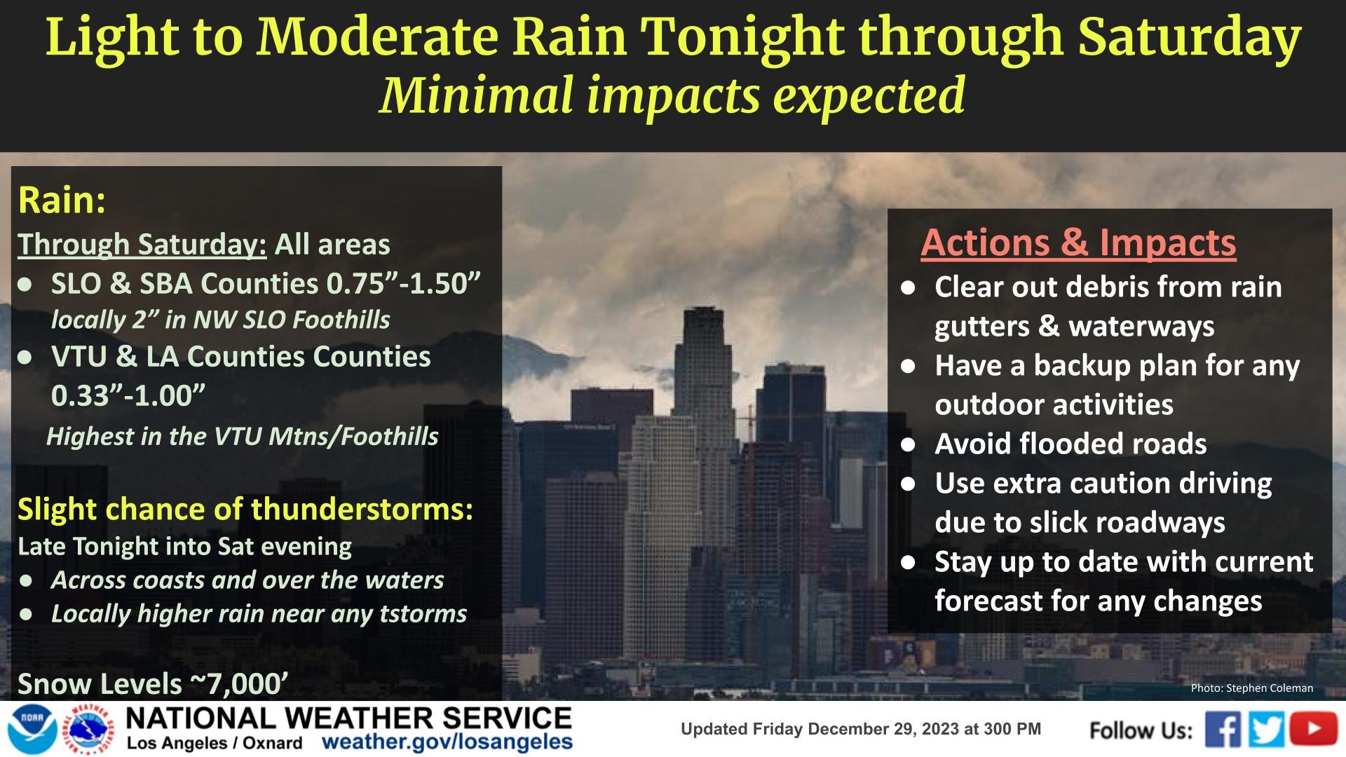
Beginning Friday night, light to moderate precipitation is expected to last through late Saturday night, according to the National Weather Service.
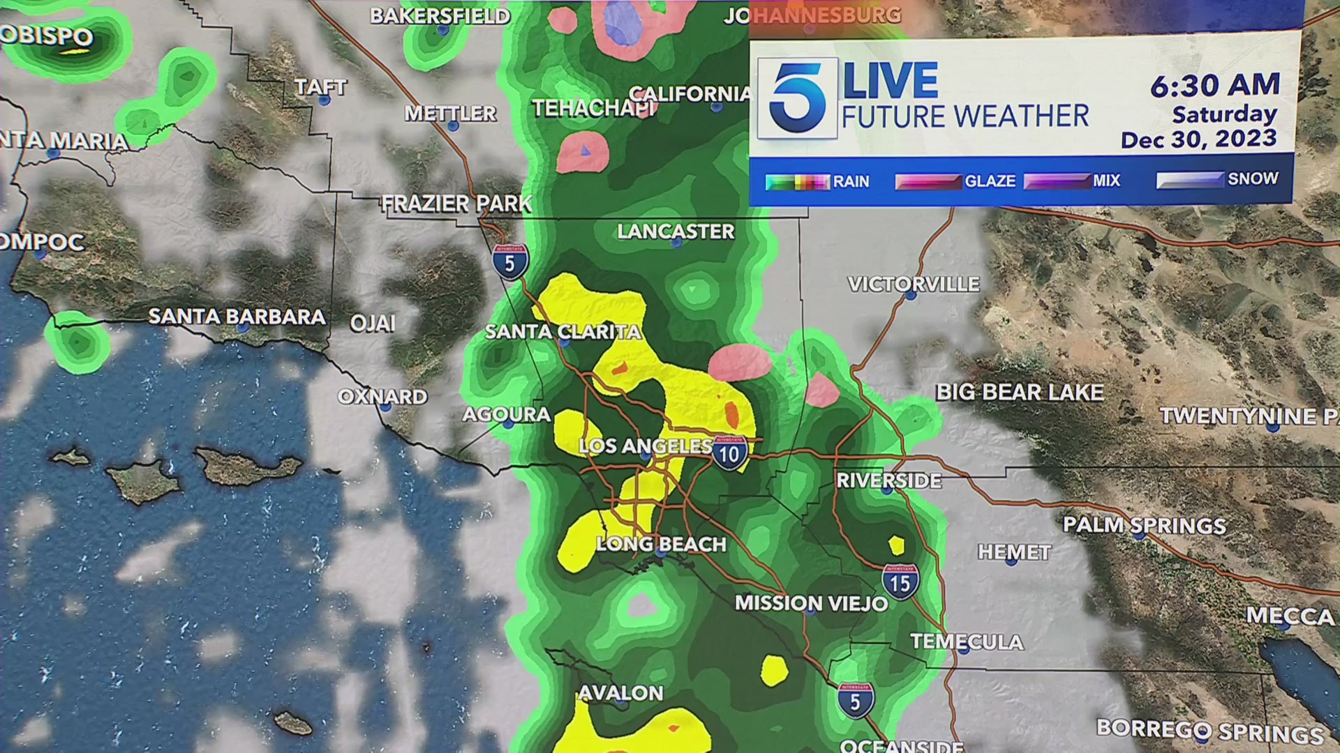
“For the cold front, you can see the storm hitting San Francisco before moving into Los Angeles County overnight,” explained KTLA meteorologist Kaj Goldberg. “By about 6 a.m. Saturday, we’ll see the mid-morning hours picking up some rainfall for Orange, Riverside, and San Bernardino counties.”
Chances of thunderstorms will be active from late Friday through Saturday evening. The highest chances for showers will be across coastal regions and over ocean waters.
“Rain at the coasts may enhance any coastal flooding, especially near higher terrain,” said NWS. “Heavier rain is possible near any storm that forms.”
Los Angeles and Ventura counties can expect anywhere from 0.33 to 1 inch of rainfall. The highest amount of precipitation will cover mountain and foothill areas.
A Winter Weather Advisory will begin Saturday from 4 a.m. to 10 p.m. Around three inches or more of snow is expected at elevations over 6,500 feet.
“By 10 a.m. Saturday, we’ll start to see the snow make its way through Idyllwild, Big Bear and Wrightwood,” Goldberg said.
There’s a break in the weather for New Year’s Eve before a 20 percent chance of drizzle arriving on New Year’s Day. This may affect those waiting to watch the Rose Parade so bringing raincoats and umbrellas is advised.
“Early Monday morning, we’ll begin to see a very weak system starting to skirt the coastline of Southern California giving us a slight chance early Monday morning of some light showers,” Goldberg said.
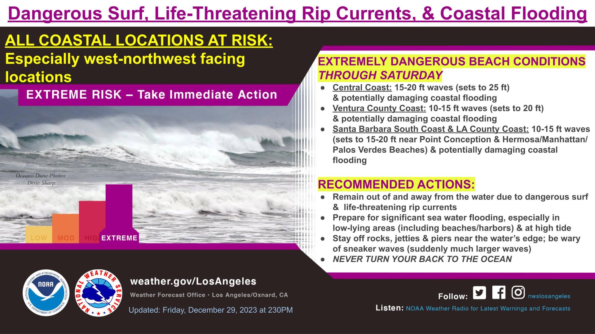
With thunderstorms threatening coastal regions, paired with the dangerous high surf pounding SoCal beaches this week, officials are urging the public to prepare and take caution.
“The Southern California coastline is currently experiencing a series of large swells which has produced some extremely large surf ranging from 10ft-15ft with even larger sets,” said the L.A. County Fire Department.
A high surf warning was issued by NWS through Saturday at 10 p.m.
“Due to the extremely large surf and hazardous conditions, we are recommending that people not enter the water at this time,” county officials said. “Lifeguards have responded to a number of distressed swimmers, surfers, and boaters.”
Some ways to prepare for the stormy weather include:
-Clearing out debris from rain gutters and waterways
-Having a backup plan for any outdoor activities
-Avoiding any flooded roads
-Using extra caution when driving due to slick roadways
-Staying up to date with the current forecast for any changes