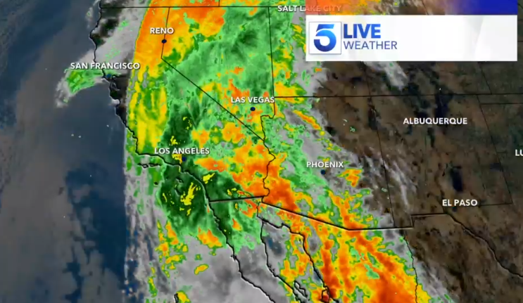
This page features the latest satellite and radar composite imagery for Tropical Storm Hilary, which will impact Southern California Sunday into Monday.
This map will move from time to time to provide you with different views of the storm and its impact on the region.
No tropical storm has made landfall in Southern California since Sept. 25, 1939, according to the National Weather Service. The watch warned of numerous potential threats to life and property including extreme flooding, mudslides and tornados.
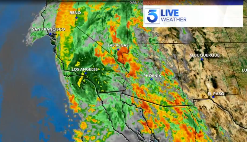
Hurricane officials said the storm could bring heavy rainfall to the Southwestern United States that could dump 3 to 6 inches in parts with isolated amounts of up to 10 inches to portions of southern California and southern Nevada, hitting large desert areas unaccustomed to much rain.
Storms don’t usually hit Southern California because prevailing winds usually push them either due west into open ocean or northeastward into Mexico and other parts of the U.S. Southwest, said Masters and Massachusetts Institute of Technology hurricane professor Kerry Emanuel.
The Associated Press contributed to this report.