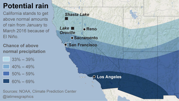
El Niño-fueled storms have left apartments teetering on a cliff’s edge near San Francisco, and snow has piled up in the Sierra Nevada mountains, with the water content 111% of normal.
Yet Southern California has been in a dry spell for the last three weeks, which is expected to be briefly interrupted this weekend with the arrival of a blustery storm.
But that storm should move out by Monday, replaced once again by dry, mild weather.
The biggest reason for the contrast between the wet north and the dry south is masses of high pressure sitting southwest of California, and on top of Southern California and Nevada. This type of system repels storms.
Click here to read the full story on LATimes.com.
34.959208-116.419389