LAS VEGAS (KLAS) – NASA has published new photographs taken from space of the drastic water loss seen at Lake Mead over the last twenty years.
The natural-color images below were taken on July 6, 2000, and July 3, 2022, by Landsat 7 and Landsat 8. The detailed images also include a view from Landsat 8 on July 8, 2021 (middle).

Lake Mead and much of the Colorado River basin have been experiencing a 22-year drought. As of July 19, 2022, the water elevation at the Hoover Dam was 1,040.99 feet above sea level; the water elevation at the end of July 2000 (around the time of the Landsat 7 image above) was 1,199.97 feet.
Above Lake Mead, Lake Powell is currently filled to just 27% of capacity, and the entire Colorado river system stands at 35%.

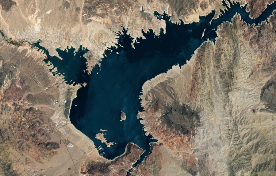
Lake Mead – July 3, 2022 (NASA)

Click the image above to see a higher resolution photograph.
Experts say climate change and drought have led to the lake dropping to its lowest level since it was full about 20 years ago.
U.S. Bureau of Reclamation Commissioner Camille Touton said last month that the agency would take action to protect the system if the seven states in the Colorado River basin don’t quickly come up with a way to cut the use of up to 4 million acre-feet of water — more than Arizona and Nevada’s share combined.
An acre-foot is about 325,850 gallons (about 1.23 million liters). An average household uses one-half to one acre-foot of water a year.
The two states, California and New Mexico already have enacted voluntary and mandatory cuts. Water from some reservoirs in the upper basin — Wyoming, New Mexico, Colorado and Utah — has been released to prop up Lake Powell.
Farmers use a majority of the river’s supply.