The second storm of the week, a much stronger but slower-moving system, began dropping rain on the Southland overnight.
The heaviest showers remained north of Los Angeles County Wednesday morning, with most areas seeing only light to moderate rain.
“But remember, the storm itself is still well to the north … I anticipate the heavier rain actually moving in late today. Tomorrow will be a very active day for us, ” KTLA Meteorologist Henry DiCarlo said.
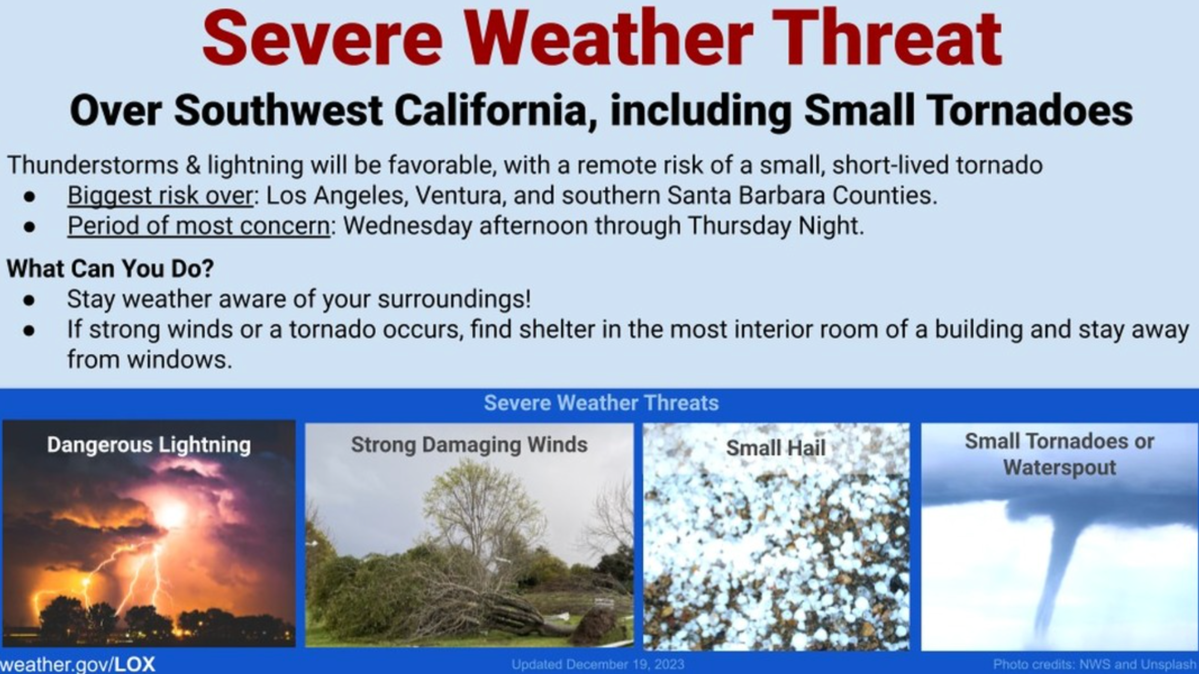
Forecasters are calling for the most dangerous conditions, including a chance of thunderstorms, to arrive Wednesday afternoon and continue through Thursday night.
“This is already a slow-moving system, so if these cells stay over you for 15 minutes, maybe 30 minutes, you could get a half-inch of rain,” DiCarlo said.
The National Weather Service warned of dangerous lightning, strong damaging winds and small hail.
“There’s even a slight risk for a tornado … this is going to be a very active storm,” DiCarlo said.
The Weather Service instructed residents on what to do in extreme conditions. “If strong winds or a tornado occurs, find shelter in the most interior room of a building and stay away from windows.”
The storm is expected to bring its heaviest rain to Santa Barbara, Ventura and Los Angeles counties.
A flood watch is in place through late Thursday night, according to the Weather Service.
Orange County and the Inland Empire will also get decent measurable rain but may have to wait until Friday afternoon to see their strongest showers, DiCarlo said.
Overall, the Weather Service is calling for the storm to bring 2 to 4 inches of rain along the coasts and valleys through Friday.
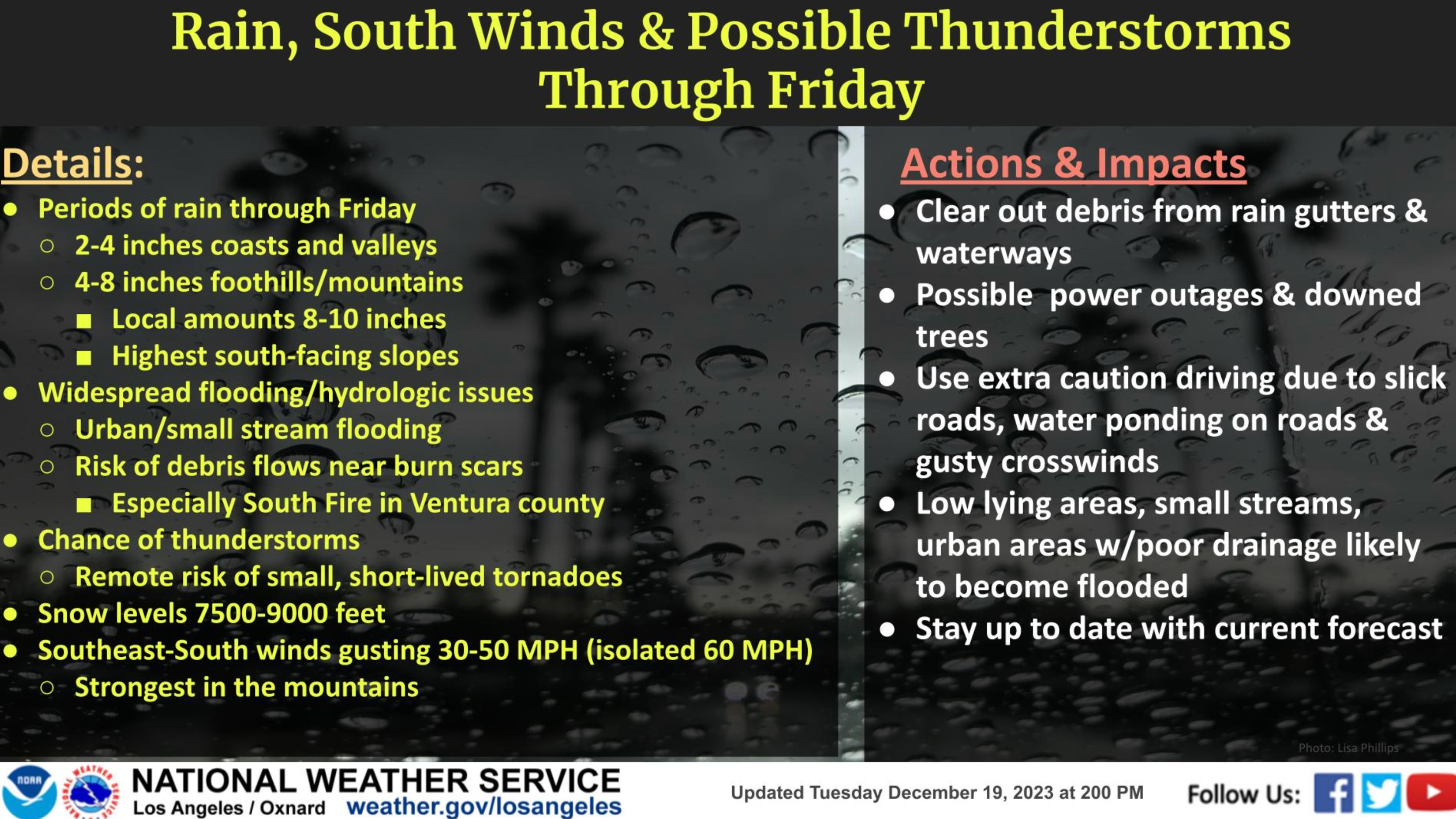
Mountain and foothill areas may see 4 to 8 inches of rain, with isolated areas getting as much as 10 inches or more.
Officials are warning of widespread flooding and the risk of debris flows, especially near burn scar areas.
Snow levels are expected to remain high, starting around 7,500 to 9,000 feet.
Gusty southeast winds between 30 and 50 mph, with some gusts to 60 mph, are also possible. The strongest winds will be in the mountain areas, according to the weather service.
Showers could linger into Saturday morning but patches of sunshine are also expected.
Dry conditions with some sunshine should return by Christmas Eve and continue through Christmas.