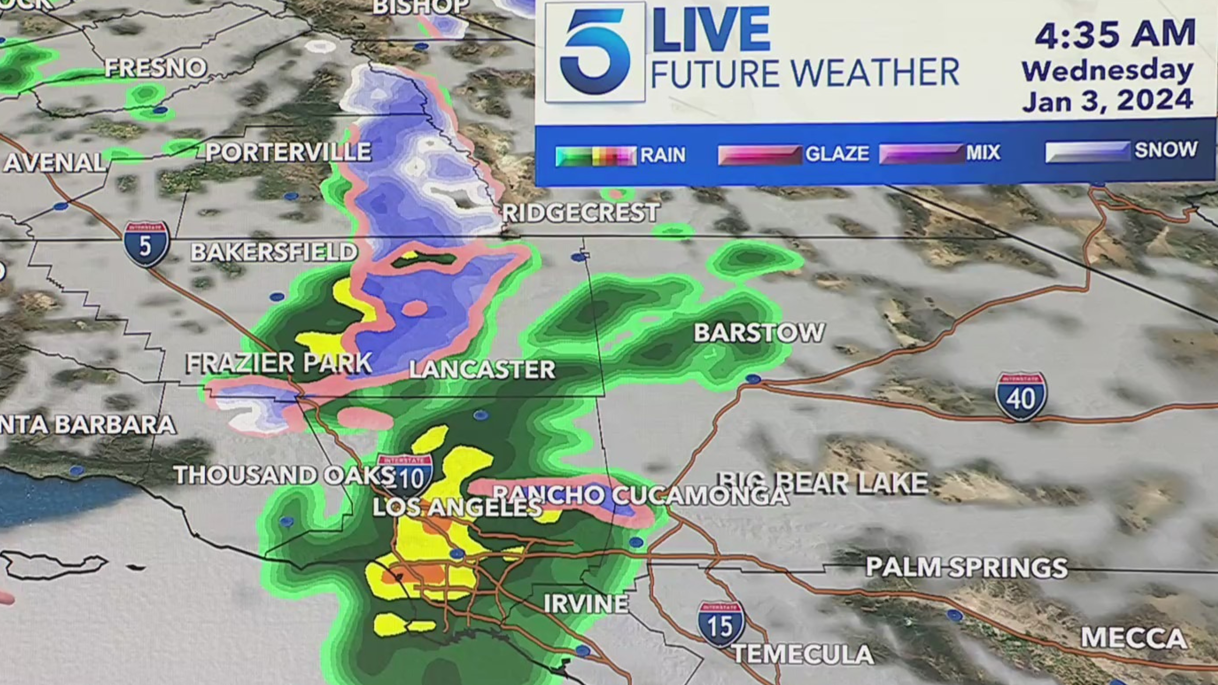
The first in a series of cold weather systems will barrel down on Southern California overnight, bringing another round of rain and snow to the region Wednesday morning.
“Kind of a quick hitter with the storm … most of the rain will develop overnight through our morning hours,” KTLA meteorologist Henry DiCarlo said.
We could see clearing by Wednesday afternoon but a lingering chance of thunderstorms will remain, DiCarlo said.
A winter storm advisory will go into effect for our mountain communities overnight and continue through 10 a.m. Thursday, according to the National Weather Service.
Snow accumulations of 3 to 6 inches are likely, with isolated amounts up to 8 inches possible
across higher elevations, according to the Weather Service.
Snow levels could drop to around the 4,000-foot mark, possibly impacting traffic on the 5 Freeway through the Tejon Pass.
As for the rain, widespread showers are expected to bring between 0.25 and 0.75 inches of rain through Wednesday morning, according to the Weather Service.
Some isolated communities could see an inch of rain from the system if they get help from a thunderstorm, DiCarlo said.
The arriving storm will increase the surf along the California coast on Tuesday, prompting officials to issue high surf advisories and beach hazard statements through Thursday.
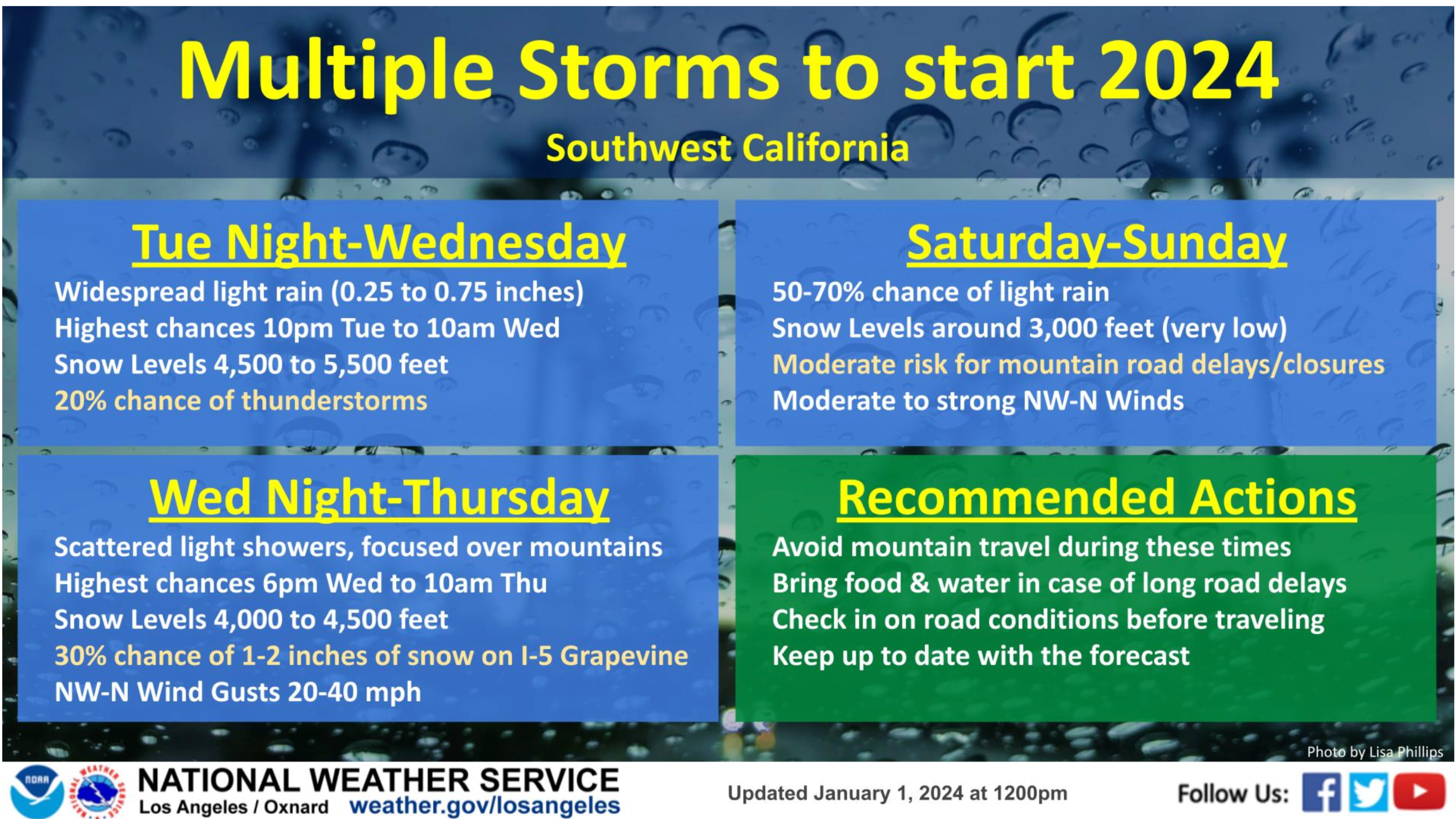
Another chance of light showers arrives overnight Wednesday into Thursday, with snow possibly impacting the Grapevine.
And an even colder storm is forecast to arrive on Sunday, with only light showers expected but snow levels could dip to around 3,000 feet.
Drivers are urged to avoid mountain travel during these times to check on road conditions before heading out.