Another storm system is headed to Southern California, bringing the potential for flooding, damaging winds and hazardous driving conditions.
Showers will arrive beginning Thursday night and will continue through Saturday, according to the National Weather Service.
Los Angeles and Ventura counties are expected to see light to moderate rainfall totalling half an inch to 1.5 inches.
Santa Barbara and San Luis Obispo counties will receive heavier rainfall during the storm with expected totals of 2 to 4 inches. Five to 10 inches are forecasted for the San Luis Obispo County foothill and coastal regions.
“It won’t be one of those cold, wintery storms,” said KTLA Meteorologist Kaj Goldberg. “But nonetheless, we will see measurable rainfall.”
Higher elevations, mostly above 10,000 feet, will see snowfall this weekend with “significant avalanche danger at about 5,000 feet,” said NWS. Areas 5,000 and below can expect significant snowmelt due to warmer temperatures and rain.
A wind advisory is in effect for northern Ventura and Los Angeles counties as well as for San Gabriel Mountain communities until 12 p.m. Friday.
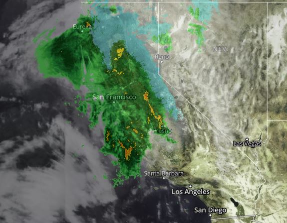
Flooding is also possible throughout the Southland. The ground is still saturated in many parts of the state, so flooding risk remains high through Sunday, NWS said.
A Flood Watch is in effect for the Santa Barbara and San Luis Obispo counties.
Drier weather is expected Sunday and Monday with another potentially strong storm possible starting Tuesday.
As rainfall creates slick roads and dangerous driving conditions, residents are advised to seek shelter when possible and to travel safely if heading out.
“Stay home if you can, and do not cross flooded roads,” advised NWS.