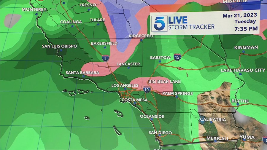
After a break from the last storm system, more rainfall is on the way for Southern California next week.
The heaviest rain is expected to arrive early next Tuesday morning and will last through Wednesday.
“This will be a soggy first half of the week, with many hours of light to moderate steady rain,” said the National Weather Service. “Expect plenty of water, rocks, mud on roads, and minor urban and creek flooding.”
Chances for scattered showers and light drizzle could begin as early as Monday in some areas.
In Los Angeles and Ventura counties, rainfall is expected to begin Tuesday morning and continue through early Wednesday, NWS said.
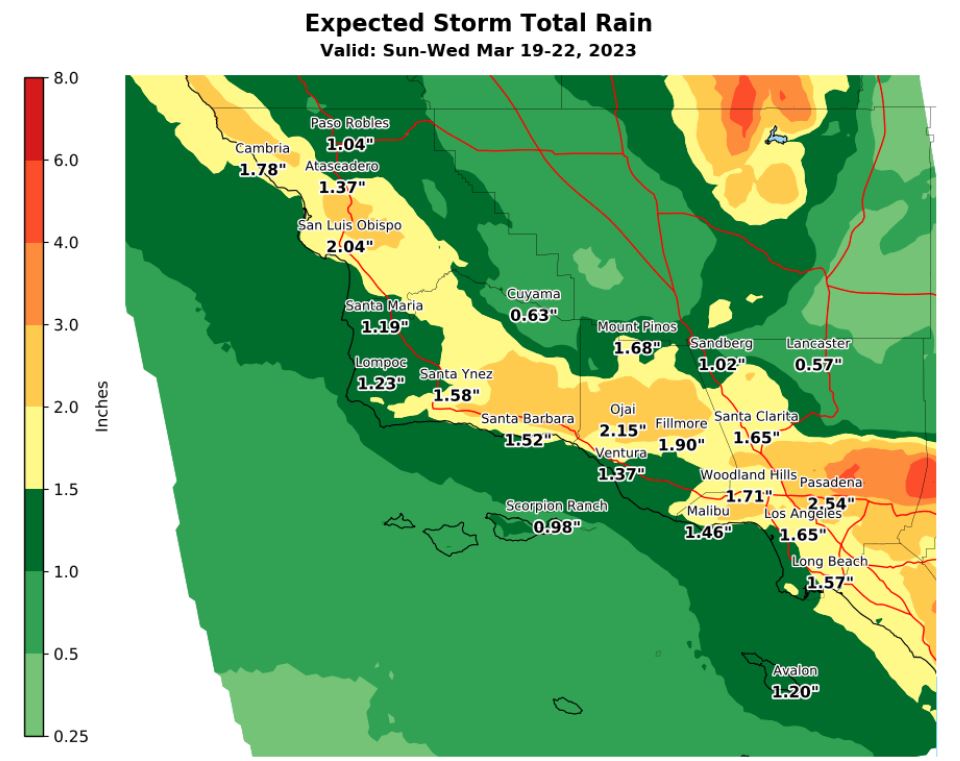
Total rainfall is expected to total 1-2 inches from Monday through Wednesday and up to 3 inches in the mountains.
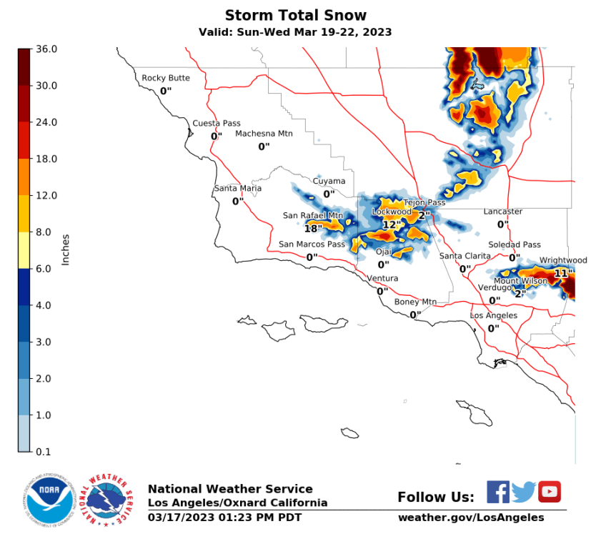
“The next storm is forecasted to be colder than the last one, so snow levels will lower to around 3000-4000 feet by Wednesday morning,” said NWS.
Higher-elevation mountain passes and canyons could see light snow accumulation as well.
“At resort level and above, 1-2 feet of snow is expected. Light snow up to 2″ is possible over the Tejon Pass, so travel will likely be impacted,” warns NWS.
Gusty winds and high surf will create dangerous conditions along the coast.
Boaters are advised to remain in port, seek safe harbor, and/or secure their vessels from severe wind and combined seas. Beachgoers should stay back from the water’s edge and off any coastal rocks.
As rainfall creates slick roads and dangerous driving conditions, residents are advised to seek shelter when possible and to travel safely if heading out.
Flooding and debris flow is especially pronounced in recent burn and mudslide areas, NWS said.
A spike in water rescues was required in the Inland Empire this month after authorities say drivers kept ignoring closure signs and barricades blocking dangerously flooded roads.