A couple of storms will make their way to Southern California over the next seven days, one of which is expected to bring a significant amount of rain and could impact your weekend plans.
The first system is forecast to move over the region on Wednesday but doesn’t look very impressive.
“Weak, weak system coming up on Wednesday. Maybe we get a little drop out of this but not much to be concerned about,” KTLA Meteorologist Henry DiCarlo said.
The National Weather Service is calling for fair skies and seasonal temperatures to return Thursday and Friday, but they won’t last long.
“Then we get to Saturday and we have rain … Overnight Saturday into Sunday, maybe even into Monday as well, we’re going to get periods of rain,” Henry said.
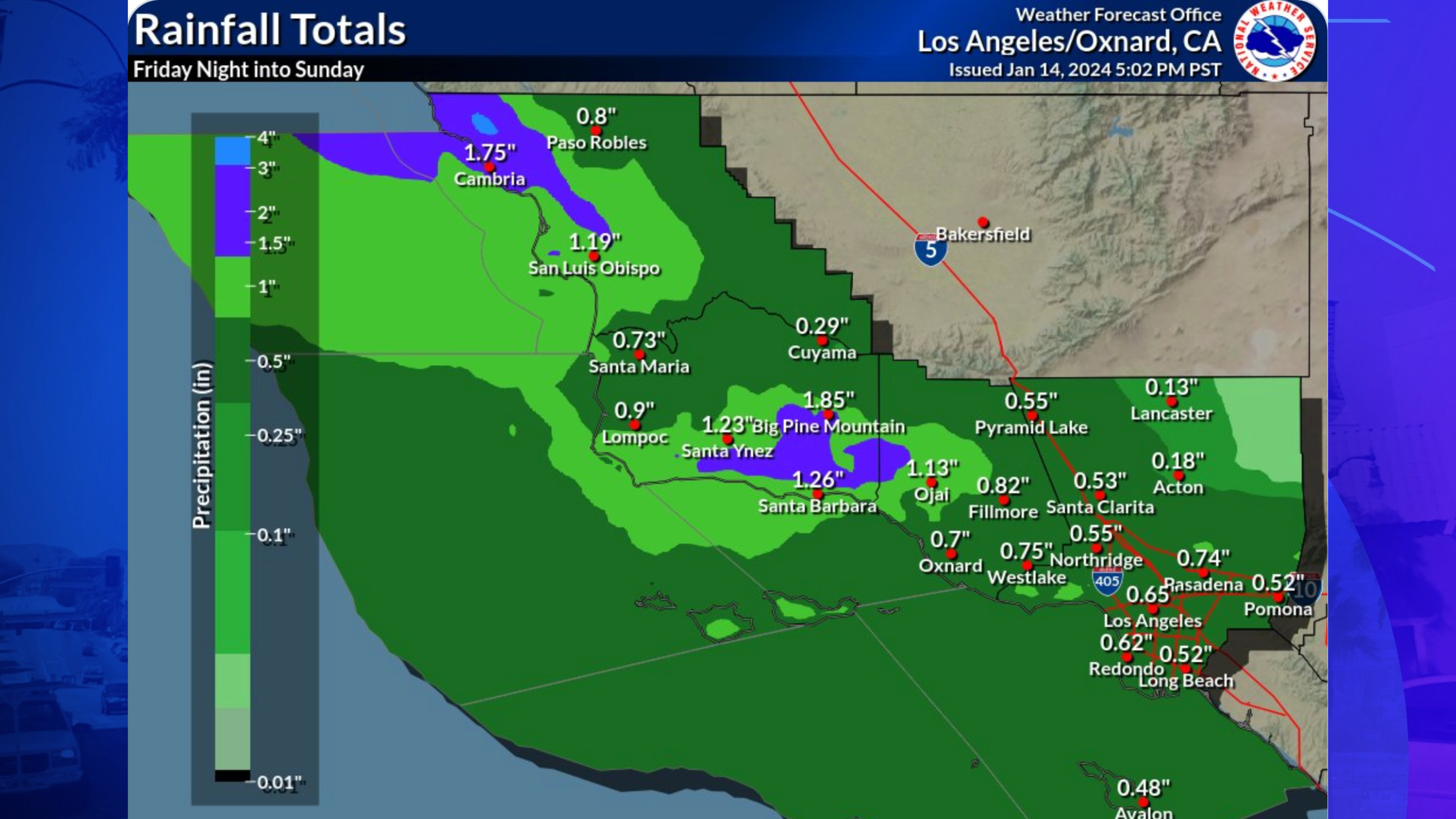
Early estimates call for a half-inch to an inch of rain in most areas, with the possibility of some mountain and foothill locations receiving more than two inches.
“Most everywhere will see rain during the 3-day period, but there will be dry instances as well,” according to the NWS.
This will not be a cold weather system and will not have a significant impact on temperatures, Henry said.
“Not big snow producers for us, but definitely the possibility of some areas getting an inch to two inches over that time frame,” he said.
Snow levels are expected to remain rather high, around 7,000 to 8,000 feet, according to the NWS.